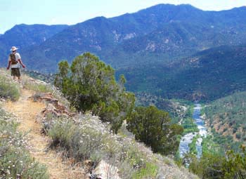
Rugged and rough trail traversing the hills above the upper Kern River.
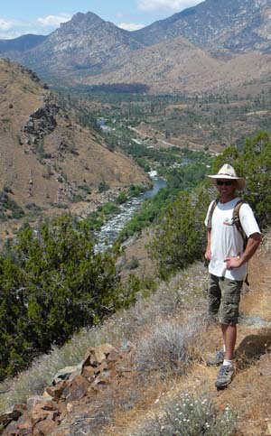
On the trail above the Thunder Run. |
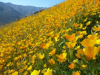 |
| Wild Flowers just north of Riverkern. |
THE STATS
- 1-20 miles with several options.
- 700+ feet of climbing.
- Up & back trail with some loop options
- 3500 ft elevation
- Map: Kern River Sierra Outdoor Rec Map
- Note: This old route is not an official USFS Trail and is not maintained.
|
On the Trail
 |
| The Camp 3 connector trail. |
The Old Flume Trail, also known as the Edison/SCE Trail and Opium Trail, adds miles of hiking trails close to Kernville.
 |
| Appreciating the impressive views looking south. |
Some of the description below is taken from the mountain bike ride trail description (click for additional trail photos):
Cutting across the steep slopes of the Kern River canyon, this super scenic trail has many miles of very tight singletrack undulating through a variety of terrain. Sometimes it weaves along golden hills of sierra grass, then dives into small creek drainages, and moves on through a scree-filled mountainous land.
This historic and well-built trail is left-over relic from the hard working men of another time. Local lore states that their grandiose effort was sustained by a substance; opium. Most likely whiskey helped too; but the parallel trail across the river got that name.
In several places along the upper Kern River, one can see the rock-enforced trail carved out of the mountain sides on its way toward the SCE flume pipes above the KR3 Powerhouse.
With the exception of a few hikers, hunters, and bikers, the trail network was out of use for decades and suffered through various fires, rock slides, brush and tree fall over the years.
Its still a brushy rough trail, but its quality is improving rapidly with more use.
Hiking Options
Get a good map! Since the trail is intersected by dirt roads every few miles, the sections of trail could be described as follows from north to south (more on this here):
- Rincon to Goldledge Creek
- Goldledge Creek South
- Corral Creek North
- Corral Creek South (there are 2 options here)
- Thunder Section
- Yellowjacket Section
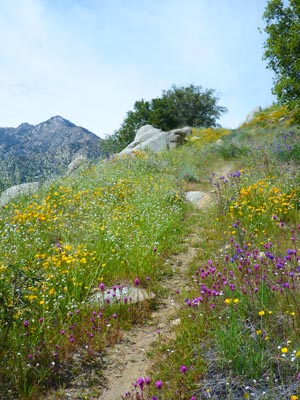
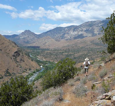 |
| Hiking north from the Camp 3 Trail. |
One of the best access points is to hike up the Camp 3 Trail, located about 3 miles north of Kernville. The trail, the remains of an old access road, climbs to the Old Flume Trail from a dirt road south of the Kern Slabs / Kernville Dome. It is located across from the south end of the Camp 3 Campground. One good option is to hike north above the Kern Slabs. This section of trail often has bright wildflower displays in the spring, and awesome views of the Thunder Run section of the river.
Several of the SCE Flowline Roads between Riverkern and Ant Canyon, also provide access to the trail.
Nearby Trails
|