Hike into the Golden Trout Wilderness to access the Wild & Scenic Kern River and The Little Kern River and Kern Flat.
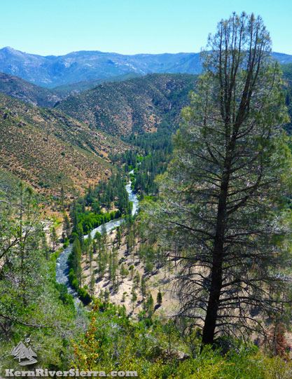
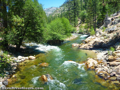
Looking at the Kern River from the Forks of the Kern Trail (Kern Flat Trail), 33E20. |
THE STATS
- Miles: 4.5 miles minimum roundtrip. Many more possible.
- Elevation Gain/Loss: 1100+ ft
- Hike: Up & back
- Tread: Singletrack Trail, mostly in Wilderness.
- Elevation Range: 5800 ft - 4680 ft at Little Kern River
- Scenery: Dispersed forest, scattered trees, chaparral
- Fishing: Excellent! Special regulations
- Land: Sequoia National Monument & Golden Trout Wilderness
- Where: Johnsondale area, from M50/M99
- Trailhead: Rd 20S67, off Lloyd Mdw Rd
- Highlights: Hiking, Backpacking, Fly Fishing, Whitewater Kayaking, Kern River, Little Kern River
- Note: Do not cross or swim in the river at high flows. There is NO bridge crossing the Little Kern River. Watch for rattlesnakes!
- Map: Kern River Sierra Outdoor Recreation Map, 6th
|
Recent Updates!
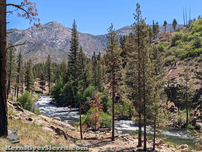 |
Photo from the trail, June 2022, upriver of the Rattlesnake Creek drainage.
|
June 1, 2023: Lloyd Meadow Road is still closed due to winter storm damage. Hopefully it opens soon!
June 2022: The Forks of the Kern Trailhead for Golden Trout Wilderness has finally opened after 2 years of closures due to wildfires. The trail dropping down to the river still has some greenery and a few trees left, but it is certainly a much sunnier experience after multiple fires. The trail has been maintained down to the river, but the rest of the Kern Flat Trail is a bit rougher. While the trail is still passable, there are numerous logs down with new paths going around them. Horse riders have created numerous ride-arounds where needed.
North of the Kern Flat Bridge, the trail is in much worse condition and hard to find in a few sections. It certainly needs trailwork. Motivated and experienced hikers wont have a problem finding a way through.
The good news is that the fire intensity was relatively low in many of the areas along the river, and actually burned out some of the annoying brush and older downed trees.
The fishing is absolutely incredible right now.
Here are some photos from June 2022:
 |
 |
 |
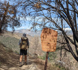
| Entering the Golden Trout Wilderness. |
A few miles upriver of the Little Kern River. |
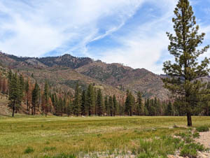
Kern Flat with Hocket Peak in the background. |
Hiking to The Forks of the Kern
The Forks of the Kern Trailhead is one of the primary gateways for hiking countless miles in Golden Trout Wilderness. It also allows for relatively quick access to both the upper Wild & Scenic Kern River and the Wild & Scenic Little Kern River. The "Forks" refers to the confluence of these two rivers.
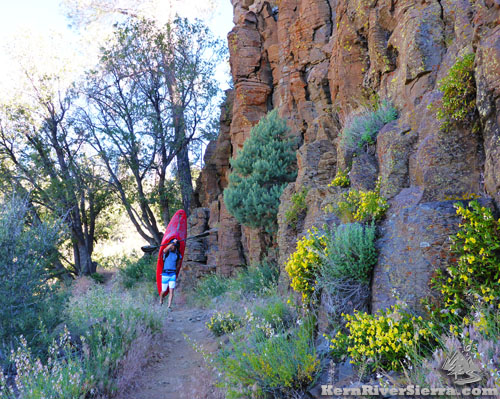 |
In the early summer, this may be a normal sight. A kayaker hikes his boat down to run a remote section of the Kern River. |
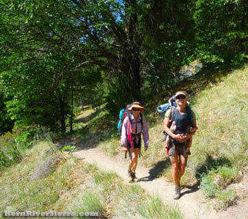
With all of the river access this trail provides, its no wonder that fisherman, day hikers, and backpackers all enjoy this hike.
In the late Spring and early Summer, one may run into a strange type of hiker - whitewater kayakers! This trail leads to the "put-in" for a famous expert whitewater run also known as "The Forks of the Kern Run" that ends after 18 miles at the River Trailhead at Johnsondale Bridge (another great hike!).
On the Trail
While most people call this the Forks of the Kern Trail, the official name of this trail is Kern Flat Trail, 33E20. The trail continues all the way up the Kern River to Nine-Mile Creek via Kern Flat.
0 Miles: From the parking area, the trail descends to the Little Kern confluence through numerous switchbacks with a moderate grade. Keep in mind that hikers will have to climb back up over 1100 feet in elevation to return.
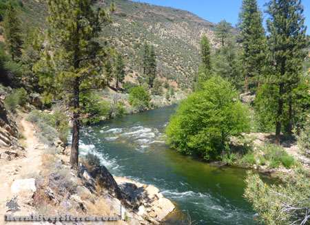 |
Up the Kern River, on the other side of the Little Kern. |
2 miles: After passing views of the southern Kern River Valley and mountains, some amazing metamorphic cliffs in the distance, and eventually the rugged land to the north, the trail arrives at a junction in a flat area near the two rivers.
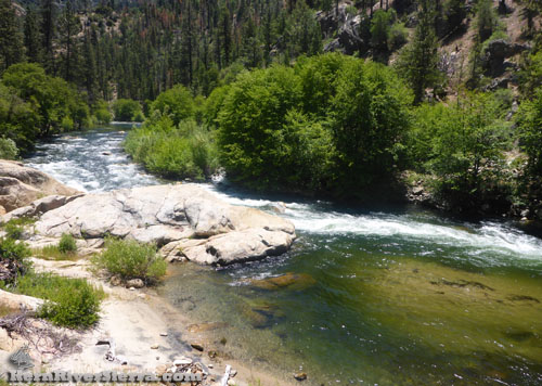
Use-trails head toward the whitewater launch spot near the confluence on the Little Kern River and head down the Kern River (to the right). One can hike about 1 miles downriver and access a few campsites and great fishing pools. Much of the river is obscured by trees and bushes.
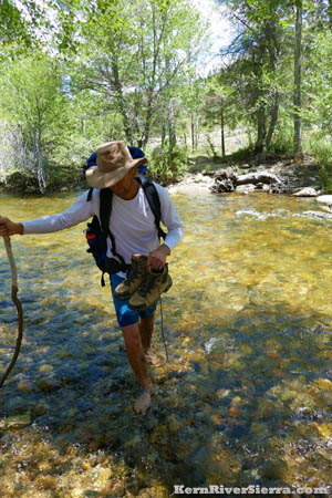
The official trail heads north and briefly up the Little Kern River crossing. Sometimes is it too high to cross, use your best judgment or hike upstream to look for other options. Check the Kern River Flows here.
On the other side, the trail will follow the North Fork Kern River for almost 8 miles to the Kern Flat Bridge. There are numerous campsites and river access points along the way.
 |
 |
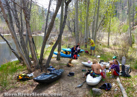
| Near the bottom of the trail in the Spring, at the Kayaker Put In on the Little Kern River. |
Hikers on the way back up. Don't forget to reserve some energy for the hike back out! |
Vague use-trails also travel up the east side of the Little Kern River here. The large sandy flood plain contains numerous campsites and openings in the tree-lined river. Explorers will find some great fishing secret spots upriver. This is also the end of a canyoneering adventure several miles and 1000 feet higher up the Little Kern.
 |
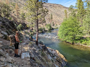
1 mile down the river from the Forks. |
The trail crosses the Little Kern River here, at lower summer flows. |
|
Special Fishing Regulations
From the USFS: "Fishing season on this section of river also runs from the last Saturday in April to the 15th of November. Only artificial lures with barbless hooks may be used. There is a 10-inch maximum size limit on Rainbow Trout with no size limit on Brown Trout on this section of river. The daily limit is 2 fish and 2 fish in possession combined."
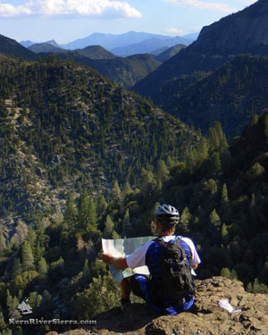 |
| Planning adventures, near the top of the trail. |
Hiking Options
This day hike can be expanding into several great backpacking adventures. One great option is Kern Flat and beyond for river lovers. From Kern Flat at the Doe Meadow Trail intersection, trail 33E20 continues another 2.2 miles to Nine-Mile Creek and connects to other trails along the way.
Another is to do a 26 mile loop of the Little Kern River via Kern Flat Trail, Doe Meadow Trail, Lewis Camp Trail to Jerkey Meadows to Fish Creek Trail.
Note that the Forks Trail (Kern Flat Trail, 33E20) also continues back toward Lloyd Meadow Road via Freeman Creek from the parking lot. One can continuously hike the trail from the Forks to Freeman Creek Trail and see the Giant Sequoias also. It also forks off at Fish Creek Trail, which connects to the Jerkey Meadows Trailhead. (Use this for hiking a large loop).
Trailhead & Directions
From the Kern River Valley, drive up M99/Sierra Way north along the Kern River about 20 miles. At the Johnsondale Bridge, cross the river and keep going up to Johnsondale/R-Ranch. Just past the ranch turnoff, turn right onto Lloyd Meadow Road, 22S82. Take this almost 20 miles, (past Freeman Creek) to dirt road 20S67. In 2.4 miles the road ends at the large picnic/corrals/trailhead/parking area.
From Parker Pass or Western Divide Hwy, take M50/Parker Pass Dr east to Lloyd Meadow Road, 22S82, just before Johnsondale. Take this almost 20 miles, (past Freeman Creek) to dirt road 20S67. In 2.4 miles the road ends at the large picnic/corrals/trailhead/parking area.
Near Kern Flat, on a bigger hike from the Forks of the Kern Trailhead. |
|
Nearby Trails & Activities
|
