A moderate hike up a trail to Packsaddle Creek and a limestone cave.
Above Packsaddle Canyon.
Update: May 3, 2019: The trail has been brushed and cleared for the first 1.3+ miles!!! Part of the descent down to the creek is getting brushy, but it improves. The trail is in good condition on the way up to the cave, except for 2 small downed logs. |
|
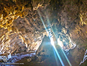 |
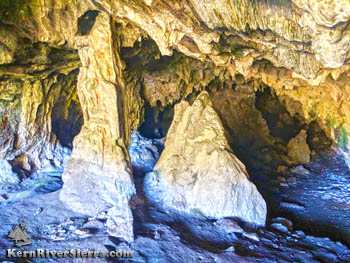
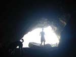
| Packsaddle Cave. |
THE STATS
- Miles: 5 mi roundtrip
- Elevation Gain/Loss: 2000 ft cumulative
- Hike: Up & back
- Trail: Multi-Use Trail (bikes allowed)
- Elevation: Trailhead 3550 ft; 4600 ft at Cave
- Land: Sequoia National Forest
- Where: Kernville, McNally's at Fairview, North Fork Kern River
- Access: Kernville Mtn 99
- Season: Best in Spring, Year-round
- Note: Bring your flashlight! Watch for poison oak in a few places. The creek can get very low in the summer.
- Map: Kern River Sierra Outdoor Rec Map
|
The Packsaddle Trail Hike
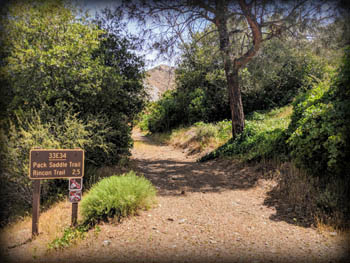 |
| The Trailhead just past McNally's. |
Packsaddle Trail, 33E34, is a non-motorized multi-use trail that ascends from the Kern River to the Rincon Trail. It passes through several different biomes along the way. After hiking up a high desert slope, the trail passes down through a riparian zone, and on to the limestone cave. Enjoy all the subtle wonders of nature along the way, before seeing the dramatic packsaddle cave.
15 miles north of Kernville; the trailhead is near the upper Whiskey Flat Trailhead above Fairview / McNally's on the upper Kern River.
Note, the new lower USFS sign labels it "Pack Saddle Trail."
 |
 |
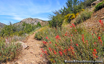
| On the initial steep incline, it's nice to stop and smell the flowers. |
On the Trail
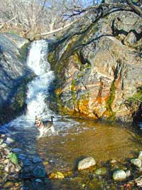 |
| Cooling off in the creek. |
 |
| A stark contrast from the trail. |
At the trailhead sign, start hiking up an old dirt road that leads to the old Fairview Mine area. Almost immediately, the trail veers right off the old road and starts ascending the high desert mountain slope.
Variety is certainly found as one hikes up this trail, especially in the spring and early summer. And thankfully so, since the first mile of this trail is tough! It can be hot and exposed, and relentlessly climbs through open chaparral to a pass.
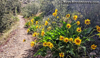
Looking around will review ever-widening views of the nearby rugged peaks and a long section of the river. In the Spring, there are wildflowers scattered along the trail, the river is raging, and the Greenhorn Mountains (across the river) usually have snow.
Stick with the hike for the first sustained steep gravely trail; it will get much better!
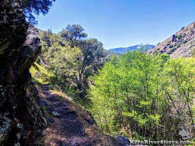 |
| A lush section of trail. |
After about a half mile the trail turns north and narrows down into nicer hiking trail. After a mile or so, the trail reaches the saddle after about 900 feet of climbing. At this elevation, you may see some of the US fighter jets training below eye level as the rocket up the Kern Canyon.
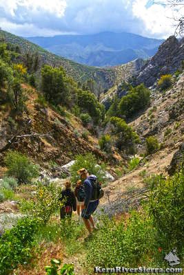
Just beyond the high point, there is a quick glimpse of the top of Dome Rock to the left, and part of Sherman Peak Massif to the right. The trail soon descends about 400 vertical feet to the Packsaddle Creek. The steep limestone ridges are seen ahead, especially when looking down the rugged Packsaddle Canyon.
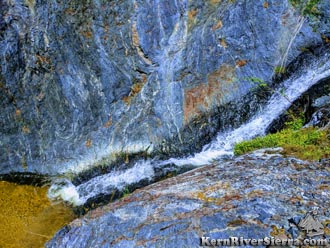
Cross the creek, and the trail continues up a secondary channel (flows in winter and spring), and then shortly climbs up the north bank. Enjoy the hike along the creek, passing some small water slides and pools on bedrock. The trail crosses the creek back to the right (south) side above one of the slides.
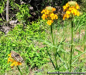 |
| A butterfly matching the flowers. |
Now on the south side of the creek, the trail passes more water slides lined with mature oak trees. Soon the trail crosses the creek again to the north side. It again follows a secondary channel in the creek bed before rising above the bank. A limestone alcove on the left foreshadows the limestone up ahead. Keep on hiking!
Under the shade of old-growth oaks, sits a nice campsite at the bottom of the main limestone ridgeline. The trail steepens a little, and the tread roughens up as it follows a dry creek bed.
Near another camp among large boulder, the the trail splits off left and ascends the hillside. (Staying straight on the lower use trail along the creek bed leads to the Rincon Trail.)
After the sharp left turn, the use-trail will lead you to the entrance of the Packsaddle Cave. If it's hot out, the cool dank air will feel amazing! Grab your flashlight and explore!
Hiking Options
Packsaddle trail is sometimes hiked as a semi-loop with Rincon Trail. One option is to hike up the southern Rincon Trailhead past Salmon Creek, and come down Packsaddle cave.
Another possibility is to hike the Rincon Trail from Sherman Pass Road near Brush Creek to Packsaddle Trail.
Trailhead & Directions
Dive 15 miles north of Kernville on the Mtn 99. There are 2 trail parking lots just north of McNally's Restaurant. The first is used for Whiskey Flat Trail, and the Packsaddle Trail parking is just north of the Fairview Campground on the west / river side. Park here, and cross Mtn 99 to the signed trailhead on the east side.
Nearby Trails & Activities
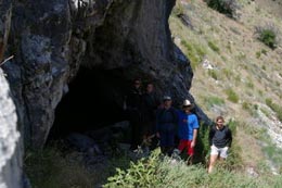
Outside the cave, not far from the Rincon Trail. |
|
|
|
 |
| |
|
|
|
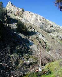
A limestone peak. |
|