A forested hike to a huge meadow and small creek, surrounded by the crags & spires of Domeland Wilderness.
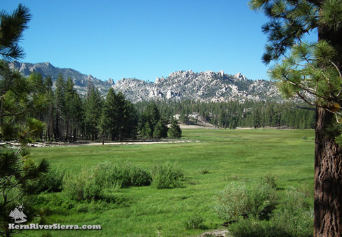
Manter Meadow in Domeland Wilderness. |
THE STATS
- Miles: 5.5-10+ roundtrip
- Tread: Wilderness Trails
- Type: Loop, or Out & Back; a few different options
- Elevation: 7,000-8300 ft
- Vertical: 1200+ ft
- Land: Domeland Wilderness & Sequoia National Forest
- Where: Kern Plateau, Big Mdw
- Access: Cherry Hill Rd/Sherman Pass Rd
- Trailhead: Big Meadow Rd
- Near: Kernville, Kennedy Meadows
- Note: Seasonal Closure
- Map: Kern River Sierra Outdoor Rec Map, 6th ed.
|
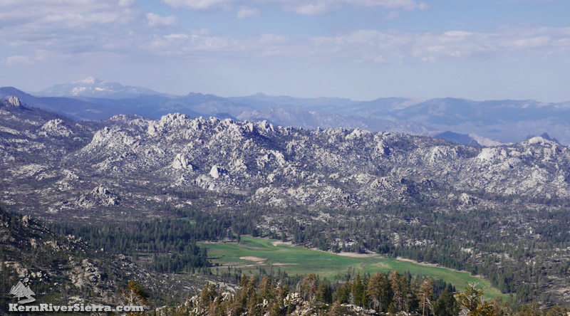 |
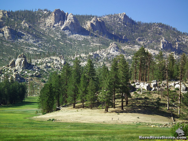
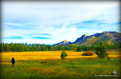
| Looking down at Manter Meadow and Domeland Wilderness from Taylor Dome. The Eastern Sierra and Olancha Peak are in the background. Sirretta Peak is just out of view to the left. |
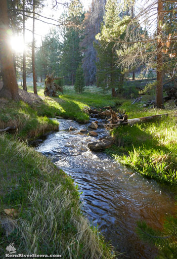 |
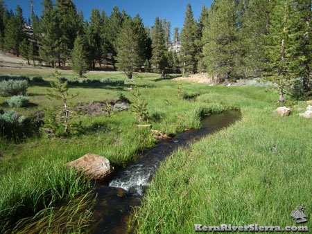
| The lovely Manter Creek. |
Hiking to Manter Meadow
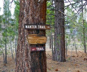
Two trails lead to Manter Meadow from the east side of Big Meadow; Manter North Trail, 34E14, and South Manter Trail, 34E37. They both climb to a saddle before descending to Manter Meadow.
Either of these trails may be taken to make a lollipop loop around Manter Meadow, or a larger loop using both trails and Big Meadow Road. All these hiking options are in the 9-10 mile range roundtrip.
For a quicker hike, many people opt for an 'out & back' on either trail, with South Manter Trail being the easiest and shortest.
The trails and options are depicted on the Kern River Sierra Map.
On the trail
Manter North Trailhead/34E14
While Manter North Trail seems to be quite popular, it is a little longer and steeper than South Manter Trail. It climbs over 500 vertical feet to a pass at the wilderness boundary and then descends through forest alongside a small creek.
In 2.5 miles it reaches the Cabin Spur Trail/34E37A (which also connects to South Manter Trail). Just beyond is an offshoot to the old Manter Meadow Cabin, an interesting building historically used by cattle ranchers. Continuing northeast on the Manter North Trail, the path reaches Woodpecker Trail in about 1 mile.
The trail provides the shortest distance to the Manter Meadow Cabin or to the northern section of Woodpecker Trail.
 |
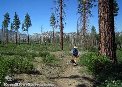
| 2 hikers on the Woodpecker Trail on the southeast side of Manter Meadow. |
South Manter Trailhead/34E37
This trailhead is located 1.6 miles further south on Big Meadow Road/23S07, near a corral. The trail quickly ascends to the pass in less than 200 vertical feet, and then follows a small seasonal creek to southern Manter Meadow. It reaches the Cabin Spur Trail/34E37A 2.4 miles.
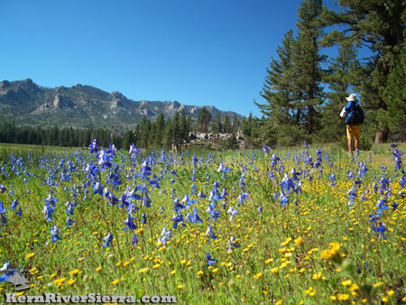 |
| Early summer colors. |
At this point hiking north on the 34E37A leads to the cabin and Manter North Trail in 1.2 miles. To the south, 34E37A wraps around Manter Meadow and then turns northeast towards the backside of Manter Meadow and meets up with Woodpecker Trail, 34E08, in .9 miles.
Woodpecker Trail/34E08
Providing many beautiful views, Woodpecker Trail is used to close the loop on the backside of the meadow. It intersects with Manter Creek Trail/35E12 at Manter Creek near some very popular forested camping areas (.5 miles from 34E37A). Manter Creek contains tiny native trout and flows down to the Wild & Scenic South Fork of the Kern River. Just north of this area, the trail passes by a slab of Native American grinding holes near some scenic camping areas.
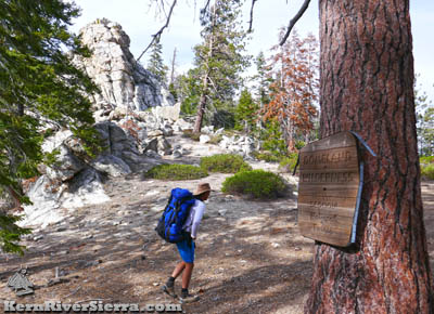 |
| The pass between Big Meadow and Manter Meadow marks the Domeland Wilderness boundary. |
While it connects to Manter North Trail (.9 miles from Manter Creek/35E12), Woodpecker Trail also continues far north to Sherman Pass Road near Bald Mountain Lookout. It is used to access several rock climbing areas (labeled on the Kern River Sierra Map) and the impressive Bart Dome. Like a secret Yosemite, Domeland Wilderness offers endless high quality rock climbing spots - but it requires more effort!
To the south Woodpecker connects with Church Dome and its southern trailhead near Taylor Meadow.
Hiking Options & Excursions
There are quite a few options for longer hikes that connect to various trails and points of interest in Domeland Wilderness.
|
 |
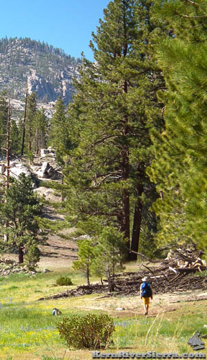
| On Woodpecker Trail, east of the meadow. |
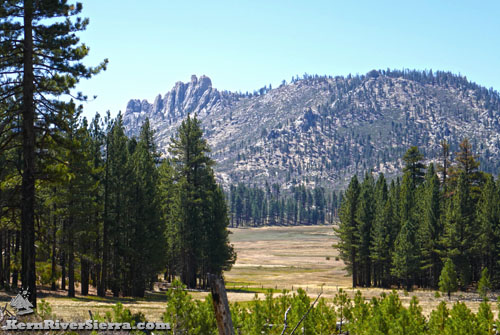
Autumn in Manter Meadow. Church Dome beyond. |
Take Manter North Trail to Woodpecker Trail and head north. The trail passes by many grand rock formations along the way. A split at Dome Land Trail, 35E10, leads to Bart Dome and Tibbets Creek. From the intersection of Manter North Trail and Woodpecker Trail, hiking to the pass at Bart Dome makes a 6.2 mile roundtrip trek with an additional 1,000 foot+ gain in elevation.
 |
| Manter North Tr near the intersection with 34E08. |
From the backside (east) of Manter Meadow, explore the Manter Creek area. Manter Creek Trail/35E12 heads straight east along the creek.
From its intersection with Woodpecker Trail, Little Manter Meadow is about 1.4 miles east.
After another .5 miles, the trail leaves Manter Creek and ascends a pass. At this point, one can leave the trail and climb Rockhouse Peak, one of the Sierra Club's 'Sierra Peaks Section' list of peaks.
The trail is quite bushy and overgrown in this area, but it eventually descends to the South Fork of the Kern River near Rockhouse Meadow.
Hike to Church Dome
 |
| Church Dome towering over. |
An out 'n' back hike to the Church Dome Saddle from the intersection of 34E37A and Woodpecker Trail is about 4 miles roundtrip and about 750 ft of vertical elevation gain on Woodpecker Trail.
Another option is to make a much larger Loop to Church Dome via the Big Meadow Trail, 34E15.
The Big Meadow Trailhead is just to the south (.1 mi) of South Manter Trailhead and passes by Taylor Dome, another Sierra Club classic peak hike.
The loop is approximately 12 miles with roughly 2600 feet of vertical elevation. A map is highly recommended for this loop hike; there are some confusing intersections complicated by numerous cow trails.
 |
 |
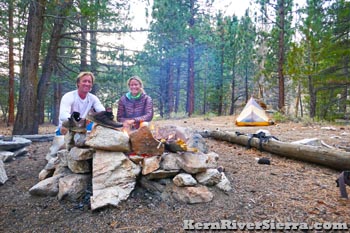
| Camping near Manter Creek Trail. |
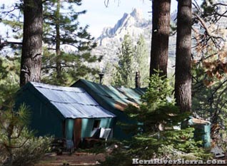
Cabin near the intersection of 34E14 & 34E37A. |
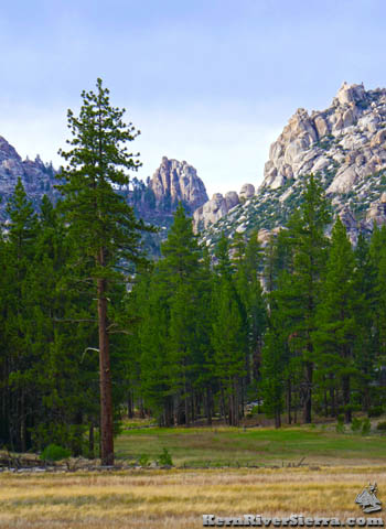 |
| Northern Manter Meadow Area. |
Other Nearby Activities
Trailhead
From Kernville, drive up Mtn 99 for 19 miles, then turn right before the Johnsondale Bridge onto Sherman Pass Drive. In 6 miles, turn right on Cherry Hill Road (22S12). After 11.5 miles, turn left on 22S07/Big Meadow Road.
After passing the North Big Meadow camping areas (Cannell Trail & Sirretta Peak trailheads) and some cabins on the left, look for the Manter North Trailhead on the left at 1.4 miles. The South Manter Trailhead is another 1.6 miles beyond.
From Kennedy Meadows, take Sherman Pass Road beyond Sherman Pass Overlook to Cherry Hill Road and (follow directions above.)
From Parker Pass Dr/M50, drive past Johnsondale and cross the Kern River. Sherman Pass Drive is just past the Johnsondale Bridge on the left. Take this to Cherry Hill Road and (follow directions above.)
 |
Left: Hiking on Woodpecker Trail. Above: Manter Creek.
|
|