Hike the tallest peak in the area for a great southern sierra vista!
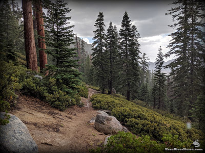
Looking down the trail in a thunderstorm.
|
THE STATS
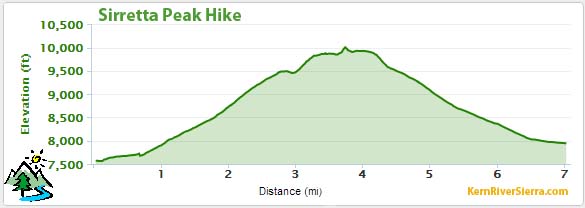
- About 7 miles roundtrip
- 2200 feet of elevation gain
- Up & Back hike
- Multi-Use Motorized Trail, with a cairned route near the top, some scrambling
- PEAK: 9977 ft
- TRAILHEAD: 7830 ft
- WHEN: Summer/Fall
- WHERE: Kern Plateau near Big Meadow
- NEAR: Kernville, Kennedy Meadows
- LAND: Sequoia National Forest
- Map: Kern River Sierra Outdoor Rec Map
- Sirretta Peak is on the Sierra Club's 'Sierra Peaks Section' list of peaks.
|
 |
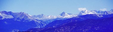
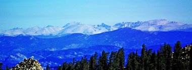
| Sirretta Peak on the right. Notice Mt Whitney peaking up over the horizon on the left, and Olancha Peak on the far right. A much more demanding hike, the "Sirretta High Route," traverses this ridge from Sirretta Peak to Bass Peak on the far left. |
Hiking Sirretta Peak
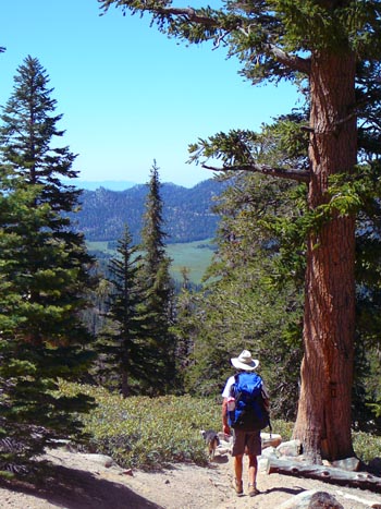 |
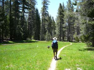
| Hiking the trail above Big Meadow. |
At almost 10,000 feet of elevation, Sirretta Peak claims a commanding spot on the Kern Plateau. On a clear day, it is one of the more wonderful viewpoints in the Southern Sierra.
Along with Taylor Dome and Rockhouse Peak, Sierretta Peak is one of the Sierra Peaks Section list from the Sierra Club.
If you like rewarding hikes with huge views in an amazing forest, don't miss this one!
On The Trail
From the trailhead at North Big Meadow (see directions below), hike up the Cannell Trail a half mile or so. After crossing the creek and passing through a beautiful meadow, the hike then turns right onto the well signed Sirretta Trail.
Before reaching Sirretta Pass, look for the cairned route climbing the ridge to the peak on the left. For the next .9 miles, follow the cairns up the ridge and then back to the southwest to the bouldery peak.
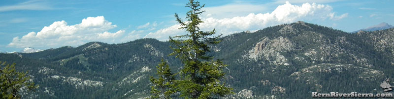
After climbing through the beautiful mature forest, some of the local sights include Big Meadow and Cannell Peak, all of the Lookout Towers in the region, Dome Rock, Taylor Dome, Church Dome, Jackass Peak, Sunday Peak, Baker Point, and the Greenhorns, Maggie Mountain, the Scodie Mountains, and The Piutes, to name a few.
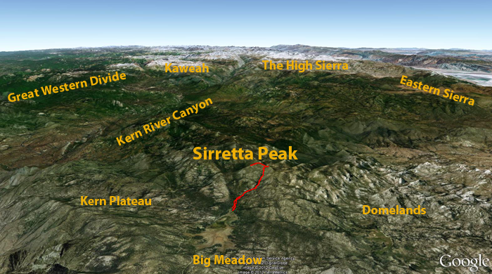 |
| Sirretta Peak and Trail as seen from Google Earth. |
 |
| In the meadow on Cannell Trail. |
The Eastern Sierra frames one side of the view with Owens Peak, Olancha Peak, Mt Langley, Mt Whitney, Mt Russell, and a few other 14ers.
On a clear day, Telescope Peak to the east in Death Valley and the coastal range to the west can be seen!
To the northwest, Farwell Gap is perfectly in view on the Great Western Divide with the impressive Kaweah Range beyond.
Exploring around will yeild more views and the old growth forest of the Twisselmann Botanical Area. The southernmost strand of rugged Foxtail Pines make their home here.
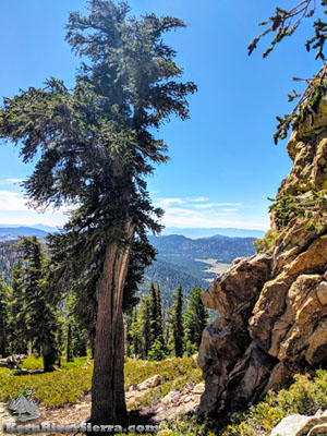 |
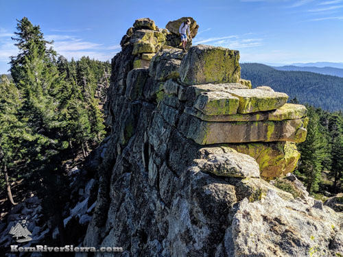
| Near Sirretta Peak. |
 |
| View over Domelands to Church & Taylor Domes. |
The Details
The trail to the pass is designated multi-use and open to motorcycles, although it is fairly unlikely to see one (except on peak summer weekends). The final mile of cairned-trail is hiking only.
While the motos can be a distraction to hikers, the OHV funds have been critical for maintaining the trails in this area. Sirretta Trail is clear and in great condition, while many other nearby Wilderness trails are disappearing under creeping brush and treefall. Stewards of the Sequoia maintains this trail every summer.
 |
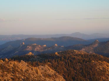
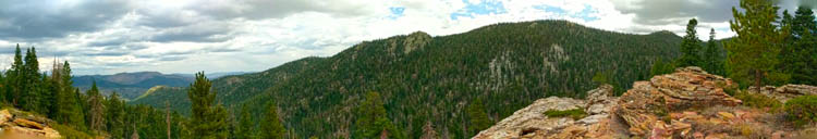
| Sirretta Ridge (the peak is just out of view to the left) and the surrounding crags and knobs of Domelands Wilderness, as seen from Taylor Dome to the south. |
Another note: The short Cannell Meadow Trail portion of the hike is very popular with mountain bikers, especially on weekends.
Just in case: If you need to de-weight before hiking, you can lighten the load in a primitive outhouse on the south of the trailhead (below road 22S07).
Hiking Options
 |
| Binocular view of the upper Kern River Canyon on an exceptionally clear day. |
Sirretta Ridge Traverse
For a VERY scenic hike, take the high route from Sirretta Peak to Bass Peak above Sherman Pass! This long difficult off-trail route scrambles along all of the high points along the ridge. Some class 3 climbing (optional) is broken up by the forest of Foxtail Pines. Hiking south to north is recommended for both sun exposure and views.
 |
| Somewhere along the Sirretta High Route. |
 |
| Traversing the Sirretta High Route. Bass Peak is just over the hill. |
Hike to Little Trout Creek
If you want an additional 2500 feet of vertical gain/drop, the Sirretta Trail continues down the east side. At Little Trout Creek, it splits. One can head into Domelands Wilderness on a very low-use trail, or loop back up north on multi-use trails.
 |
| Views from the east side of Sirretta Trail. |
Elevation Profile
 |
| How many 14-ers can you see? Mt Tyndall, Mt Russell, Whitney, Muir, and Langley to the North. |
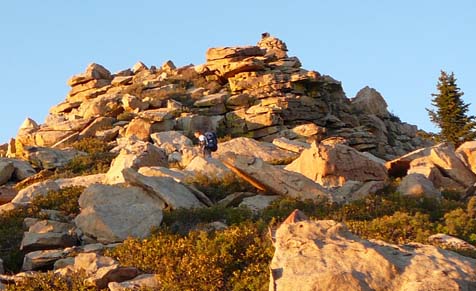 |
| The final scramble to the top is easiest from the south side. |
Other Nearby Trails
Trailhead & Directions
From Kernville, drive up Mtn 99 to Sherman Pass Road.
Turn right on Cherry Hill Road (22S12).
Before reaching Big Meadow, turn left on 22S07.
Look for the signed turnoff for North Big Meadow to the left. The trailhead is at the end of the dirt road in a dispersed camping area.
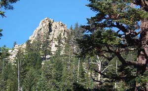 |
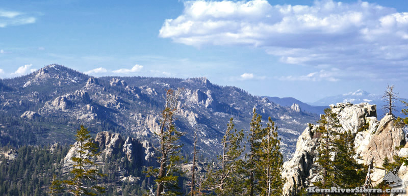
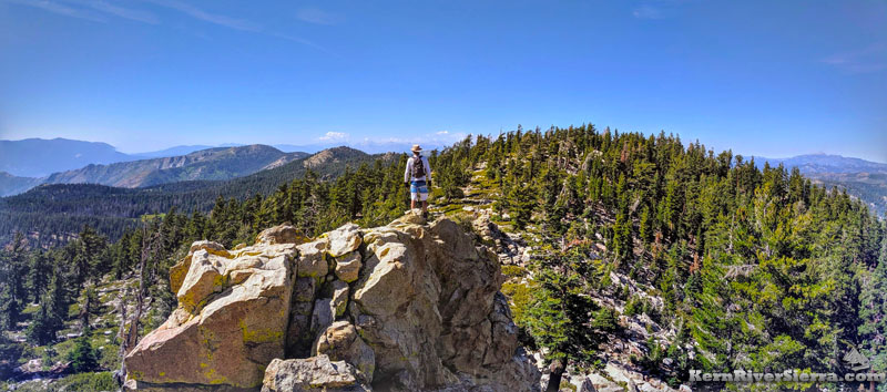
| Sirretta Ridge. |
|
