A superb short hike to a lookout tower with unsurpassed panorama views.
Hiking the Baker Point Trail through a conifer forest with vast views.
|
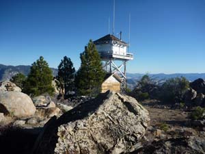 |
| Baker Point Lookout Tower |
THE STATS
- Miles: 3+
-
Effort: 400+ feet of climbing
- Tread: Up & back trail
-
Top Elevation: 7754 ft
- Land: Sequoia National Forest
- Map: Kern River Sierra Map
|
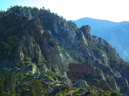
Hiking Baker Point (& Baker Peak)
Sitting at 7,754 feet, the Baker Point Lookout hovers on a granite peak 5,000 feet above the Kern River north of Kernville. Vast airplane-style views engulf the hiker who makes this inspiring trek in the Greenhorn Mountains.
 |
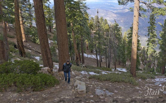
| On the trail, near the trailhead parking area. |
But even with hundreds of miles of terrain in sight, the immediate premises is impressive. The surrounding 780 acres are known as a Sequoia National Forest Botanical Area, with conifer trees (Sugar Pine, Jeffrey Pine, and White Fir) and rare plant species thriving in the rocky environment. In the spring, gorgeous pink flowers emerge from the steep slopes.
The tower, built in 1950 and no longer manned by the USFS, still has an accessible deck. The views are sweeping and spectacular. The Scodie Mountains, Piutes, Lake Isabella, Kern River, the Kern Plateau, and other Greenhorn Peaks are all in view to the south and east.
The northern vista includes Maggie Mountain, Slate Mountain, The Needles, the impressive peaks of The Great Western Divide, Kern Canyon, and Sherman Peak. Hovering over these features is the most unique and awe-inspiring sight of all! In view is the grouping of the highest mountains in the entire contiguous USA! Several High Sierra peaks, including Mt Whitney and other "14ers" line the northern horizon. Because of the north/south trajectory of the Kern Canyon, it is possible to look out to the farthest extent of the Kern River drainage, through the heart of the Sierras.
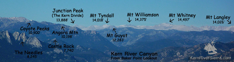 |
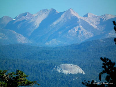
| The High Sierra peaks on the upper Kern River as seen to the north from Baker Point. You can see Junction Peak, which marks the farthest extent of the Kern River headwaters. It is the junction of Sequoia National Park, Kings Canyon National Park, John Muir Wilderness, as well as the Kern/Kings River Divide. |
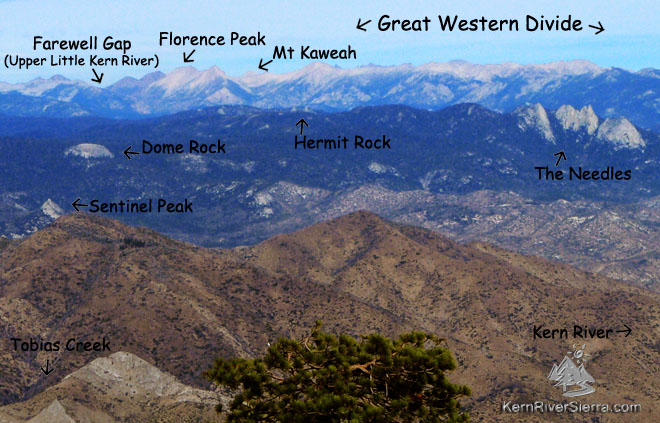 |
| The Great Western Divide peaks and domes as seen to the northwest from Baker Point. |
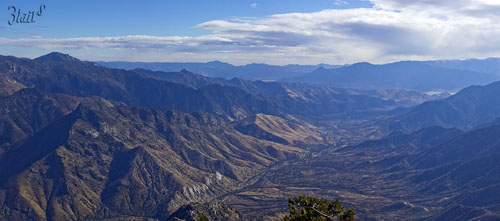 |
Looking south down the Kern River from Baker Point Lookout.
|
The Trail
At the higher elevation, this trail makes for a wonderful summer hike. In the winter, snow completey isolates this mountain from access (unless you have a snowmobile).
Even though the trail to Baker Point is short, it feels a bit longer than a mile and a half.
There is a decent amount of elevation gain, and there are some rocky sections of trail that traverse through a scree field.
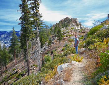
Hiking above and behind the lookout tower, yields even more of a view for the curious hiker. There is an old trail extending along the ridge to the west that takes you to a helipad used to supply the tower. Very unobstructed views can be observed from this location. And then there's also Baker Peak....
 |
| Dome Rock and The Great Divide as see from the north side of Baker Peak. |
Baker Peak
At 7926 feet, Baker Peak is the actual summit of the mountain, just to the northwest of Baker Point. It also has excellent views, and is sometimes climbed in conjunction with the lookout tower hike. From the trailhead parking ascend the ridge to the north until you are at the highest point. Its about a 2 mile cross-country trip with 500 feet of elevation gain and no trail.
Getting to the tail
Although the lookout tower is visible from parts of Kernville, access to the trailhead requires some time. Hikers must negotiate of a maze of forest roads through the Greenhorn Mountains. But the supreme views, feeling of remoteness, and a rewarding trail, make it well worth the drive.
Nearby Trails & Hikes
 |
| Kern River as seen from Baker Peak. |
Trailhead
From the Kern River Valley, drive up Hwy 155 from Wofford Heights. At Greenhorn Summit, go right on 24S15/Portuguese Pass Rd and follow
to Portuguese Pass. At the pavement, turn right 23S18 (the west side is labled 23S16). Stay on this road as it eventually descends past Tyler Meadow. At a 4-intersection, turn right on the dirt road, 23S02. Stay on this main dirt road, ignoring all offshoots, as it climbs a few miles to a large circular dirt parking area at the end. The trail is signed 32E37, and starts in sagebrush on the backside of the parking area.
From Johnsondale, drive west on M-50 a few miles, and turn right on 23S16, a paved forest road. Take this road about 20 miles until you reach the 4-way intersection with 23S02. Turn left and follow the above directions.
From Sugarloaf, drive up the paved road, 23S16, to Portuguese Pass and continue on (the road becomes 23S18). Turn right on 23S02 and follow the directions above.
 |
| The lookout tower sitting on top of Baker Point. |
|
