Newest singletrack in the alluring Greenhorn Mountains.
Enjoying the revival of the old Bull Run Trail. |

THE STATS
- 2.4 miles one-way
- Singletrack Trail
- Loop Ride: 10.7 Mi with North Portuguese Tr & roads.
- 1200 feet of climbing/drop.
- Top Elevation: 7550 ft
- Lower Elevation: 6600 ft
- Sequoia National Forest
- Greenhorn Mountains
- Access: Wofford Heights, Alta Sierra, North of Portuguese Pass.
|
UPDATE! 2022: This trail is currently closed, as well as some of the surrounding Sequoia National Forest land due to recent fires. Closure Maps are here.
2021: This trail is still in limbo, and appears to be closed to motorized use.
8/2019: Although it is still being biked a little, this trail hasnt had as much use lately - possibly due to some controversy involving the USFS and motorized users. There is no sign marking the trail, but its still there and apparently open to non-motorized use.
UPDATE! 5/12/18: Stewards of the Sequoia just cleared and brushed this trail last week. Should be good to go! |
The Trails
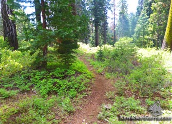 |
| 2.4 miles of new Bull Run singletrack. |
In the heart of the Greenhorns, 2.4 miles of newer twisty singletrack augment the remote network of Portuguese Pass Trails (31E59).
Thanks to the USFS, Chris Horgan, and Stewards of the Sequoia volunteers, the 100 year old Bull Run Pass Trail has been revived. When connected with the now official northern Portuguese Pass Trails, the trail forms a nice loop with the forest roads.
This multi-use singletrack travels through the shade of cedar and pine trees, and then skirts several vibrant sun-lit meadows. The cool forest provides excellent summer riding at about 7500 feet of elevation, and the trails often receive more rain and thundershowers than in other areas.
 |
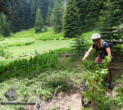
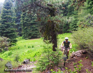
| North Portuguese Pass Trail; biker enroute to Bull Run Pass. (This trail is also used to ride out to Tobias Trail.) |
Sitting between Portuguese Pass and the Tobias Trail (32E34), The Bull Run Basin Trail roughly parallels Upper Tobias Trail and is about 1.5 miles from the turnoff to Tobias Peak.
Starting at Portuguese Pass
The ride described here contains a loop with almost 5 miles of singletrack, with the rest being on quiet dirt and asphalt forest roads.
Several variations and options exist for longer rides, including the addition of the southside Portuguese Pass Trail Loop for a great 25 mile ride.
 |
North Portuguese Pass Trail |
From Portuguese Pass (intersection of Sugarloaf Road and Portuguese Mdw Road): Take the singletrack heading north from Portuguese Pass, (31E59). The trail steadily climbs at first and then rolls up and down as it traverses through the hilly terrain.
After a mile or so, a trail splits down to the right. Officially this is the final section of the North Portguese Pass Trail (31E59). It drops down to Sugarloaf Road; continue north on this. At the first split, turn left onto the dirt road, 24S50, and ride 1.1 miles up to a saddle: Bull Run Pass.
[NOTE: At the split, most bikers will continue high on the trail, contouring left. Just before the trail turns and starts to steeply climb the hillside, turn right at about 2.1 miles. (The main trail continues up to the unbikable Bull Run Peak; while an older connector trail angles northward to the intersection of Sugarloaf Road and 24S50. It may not be obvious since the area has been messed up by recent logging).
 |
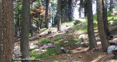
| Bull Run Pass Trail. |
The trail will soon pop out on the dirt road 24S50. Go left on the road and ride 1.1 miles up to a saddle: Bull Run Pass.
The new trail drops off to the right, curving and carving through a shady forest on the edge of bright green meadows. Over the next 2.4 miles, it crosses one dirt road, and drops about 1,000 feet. Be prepared for 3 short steep climbs at the end of the trail, as the route avoids meadows and wetlands before it reaches the paved forest road 23S18 near Dry Meadow.
Turn right and pedal the secluded road back up to Portuguese Pass (or jump back on the Portuguese North trail on the way up).
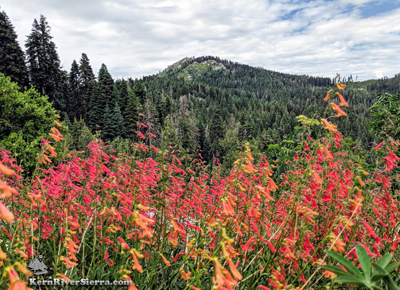 |
Tobias Peak as seen from the ride. |
Ride Variations
Most bikers will ride the main Portuguese Pass Trail (south side) 31E59.
Combining these two loops, will create a 25 mile ride with over 3,000 feet of climbing.
Bikers can park anywhere along Portuguese Meadow (Pass) Road, to shorten this double loop ride. A
great option is to park where the Portuguese Pass singletrack meets the road, such as at 3.8 miles or 5.4 miles (just after fun downhill sections) from the Greenhorn Summit Sandshed.
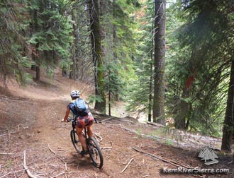 |
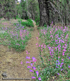
Racing through the forest. |
Other Options
Ride to the serene Frog Meadow and do the upper Tobias Trail.
The turnoff to Frog Meadow is 3 miles past the turnoff to the Bull Run pass trail.
Another option is to ride up to Tobias Peak Lookout. The turnoff is another 1.5 miles beyond Bull Run Pass Trail, and adds another 650 feet of climbing on a dirt road.
Beyond Tobias Peak, a loop is possible with Upper Tobias Trail as well.
Trailhead
From Wofford Heights, drive up the 155 to Greenhorn Summit (about 7 miles).
Turn right on dirt road 24S15 and take this 7.1 miles to Portuguese Pass, or park along the way to extend the ride.
From Posey, drive up Sugarloaf Road to Portuguese Pass.
Nearby Activities
|

