"The Trail of the Bear" makes some very FUN flowy short loops!
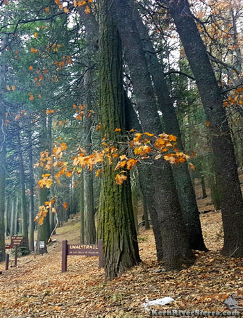
The Unal Trailhead at Greenhorn Summit. |

THE STATS
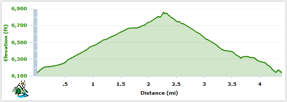
- 4.5+ miles
- 775+ feet in climbing/descent
- Non-motorized singletrack
- Loop Ride
- Top Elevation: 6861 ft.
- Where: Greenhorn Summit
- When: Spring, Summer, Fall
- Access: Wofford Heights, Alta Sierra
- Land: Sequoia National Forest
- Map: Kern River Sierra Outdoor Rec Map 6th
Often ridden as a double loop, or combined with upper Just Outstanding, and/or Portuguese Pass Trail, or the Sand Shed Trail (32E61)
UPDATE! May 15, 2025: Excellent trail conditions! And scenic park-like greenery currently. The main trail loop and the Windy Gap connector are all brushed and clear.
NOTE!!! This is a very popular hiking trail; use CAUTION on blind corners and watch for hikers and the occasional lost cow. |
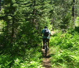
Mountain Biking the Unal Trail
This quick local favorite is an excellent forested non-motorized singletrack loop/double loop that climbs to a nice northern view of the High Sierra.
Conveniently located at Greenhorn Summit, it can easily be added to JO, Greenhorn East Rd, or Portguese Pass Trails.
 |
 |
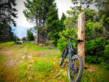
A post marks the elevation at the top;
6861 ft. Look through the trees to see
the peaks of the High Sierra! |
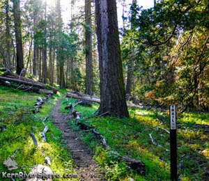
On the north side of the loop.
|
From the top view
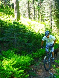 |
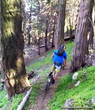
Spring riding is full of greenery.
Riding up the connector trail from the dirt road at Windy Gap. |
point area, ride down the south side of the loop (a counter clockwise direction) for a fun downhill experience. Some intial switchbacks give way to a great whoop section with jumpy rollers and a nice suprise rock drop/roller.
The west side of the loop, a USFS interpretive trail, is also quite fun and passes some Native American mortor holes.
Ways to ride it...
From the trailhead there are a few climbing options: Bikers climb both sides of the loop, as well as the dirt road that laps around the mountain.
The north side singletrack has a couple steeper switchbacks, but is mostly climbable for fit riders.
The easiest option for climbing and lapping this trail, is to ride up the dirt road 25S17 just to the north of the trailhead near the USFS Station. Once the road reaches a large open area (Windy Gap), go left on a connector trail. This leads to a turn around area at another dirt road. Go left and up the final short climb to the top of the Unal Trail.
An elevation sign, commemorative bench and some nice views greet mountian bikers at the top!
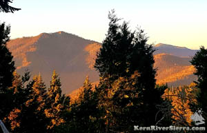
Looking out at Sunday Peak and Tobias Lookout. |
 |
| |
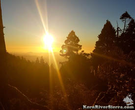
Sunset on Unal trail. Riding down the northwest side is gorgeous at this time of the day. |
Elevation Profile
Trailhead
 |
| Unal fun. |
Greenhorn Mountains near Alta Sierra.
The trailhead/picnic area is just south of Greenhorn Summit in Alta Sierra, 7 miles up the 155 from Wofford Heights.
The trailhead is adjacent to the Forest Service work station.
Parking is also available at the "sand shed" at the summit.
Nearby Activities
|