Prime time singletrack continuing on the north side of Portuguse Pass.
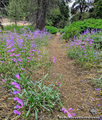
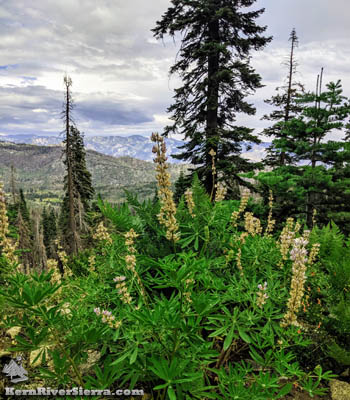
Summer flowers lining the trail. |

THE STATS
- 1.2-2.3 miles each-way
- 19 Miles Roundtrip From Greenhorn Summit
- Motorized Multi-use Singletrack Trail
- Elevation Range: 7300-7500 ft
- Sequoia National Forest
- Greenhorn Mountains
- Season: Late Spring, Summer, Fall
- Access: Wofford Heights, Alta Sierra, North of Portuguese Pass.
- Options: Loop with Sugarloaf Road
- Map: Kern River Sierra Outdoor Recreation Map, 6th ed
Update: June 2022! The trail has been completely cleared of all the logs. There is still some brush here and there, and the trail is starting to get a little looser, but it is riding fairly well! See the recent update on the main section of Portuguese Pass Trail here. |
The Trail
The trail on the north side of Portuguese Pass in the Greenhorn Mountains is the continuation of Portuguese Pass Trail (31E59), which commences near Greenhorn Summit in Alta Sierra. The primary section of this trail is legal for motorcycles; although an extended use-trail splits off and continues up to Bull Run Peak. Much of these trails follow a historical trail, and some of the old tree blazes can still be seen along the route.
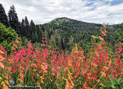 |
| View of Tobias Peak just past the northern end of the singletrack. |
With the higher elevation and greater precipitation, this zone is a wonderful place to ride during the summer months. Escaping most of the devastation of the Cedar Fire in 2016, this singletrack flows through a forest of cedar, pine, and mature black oaks.
This north-side trail can be ridden as an out-n-back or looped with Sugarloaf Road, 23S18. This is one of the routes leading to the Frog Meadow and Tobias Peak areas.
On the Bike
Commencing at Greenhorn Summit/Sand Shed, the most common ride involves pedalling 7 miles up the dirt Portuguese Meadow (Pass) Road (24S15) to Portuguese Pass. Some bikers choose to drive further along the road to shorten the ride.
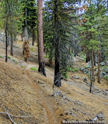 |
Sublime singletrack in the early summer. |
Once at Portuguese Pass (intersection of Sugarloaf Road and Portuguese Mdw Road), look for the trail sign (31E59) across the road.
The trail steadily climbs at first and then rolls up and down as it traverses through the hilly terrain. After about a mile, the trail splits. Officially, 31E59 splits off right and down to Sugarloaf Road (1.2 miles from the Pass), where there are options to continue north on forest roads or loop back to Portuguese Pass. This section is legal for motorcycles and is obvious to follow.
However, most mountain bikers stay high at this first split; veering left as the trail contours around a recess. The next section of trail is fun to ride at it passes through a dark forest studded with large boulders.
At about 2.1 miles from Portuguese Pass, the trail starts to steeply climb up to Bull Run Peak. At this point, mountain bikers take a side trail that veers off to the right. After recent logging (2019), this trail is not as obvious as it used to be. It currently is a skid road [not very obvious at first] and angles north for .25 miles to the intersection of road 24S50 and Sugarloaf Road. This is roughly 2.3 miles from the Pass.
 |
| Portuguese Pass Trail on the North side of Portuguese Pass; at the intersection of Sugarloaf Road and Portuguese Meadow (Pass) Road. |
Bikers can loop back on Sugarloaf Road, or ride back on the trail, or continue on 24S50 to Bull Run Pass or beyond to Tobias Peak, Frog Meadow, or Pup Meadow Trail.
From Greenhorn Summit
Starting at Greenhorn Summit in Alta Sierra: See Portuguese Pass Trail (south side). Combining these two loops, will create a? mile ride with over ? feet of climbing.??/?
Bikers can park anywhere along Portuguese Pass Road, to shorten the ride. A great option is to park where the Portuguese Pass singletrack meets the road, such as at 3.8 miles or 5.4 miles (just after fun downhill sections) from the Greenhorn Summit Sandshed.
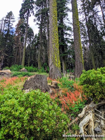 |
The surrounding forest after a wet year. |
Ride Options
Loop with nearby trails and forest roads:
Combine this trail with the Bull Run Pass Trail. [Note: Check for updates on this trail, as it's status seems to be in a state of flux.]
Ride to the serene Frog Meadow and do the upper Tobias Creek Trail. Loop back up on Sugarloaf Road. The turnoff to Frog Meadow is 3 miles past the turnoff to the Bull Run Pass. Along the way, you will pass the Sugarloaf Trail and the turnoff to Deer Creek Trail. Both have difficult access unless you have legs of steel to push you back up.
Another option is to ride up to Tobias Peak Lookout. The turnoff is another 1.5 miles beyond Bull Run Pass, and adds another 650 feet of climbing on a dirt road.
THE GREENHORN TRAVERSE
An epic ride! From north to south, ride from Double Bunk Meadow to Pup Meadow Trail, along the Tobias Crest at 8,000 ft to Bull Run Pass, to North Portugese Pass Trail to Portuguese Pass Trail to Unal Trail to Just Outstanding Trail. For an even longer ride, continue on Rancheria Road to Badger Gap Trail and Kern Canyon Trail.
BIKEPACKING
Its the Giant Sequoia National Monument, go explore it all! Besides the many obvious trails, some other highlights to check out might include the Tobias Lookout Tower and Baker Point Lookout Trail for amazing views.
See the main Portuguese Pass Trail page for even more ideas!
Trailhead
From Wofford Heights, drive up the 155 to Greenhorn Summit (about 7 miles).
Turn right on dirt road 24S15 and take this 7.1 miles to Portuguese Pass, or park along the way to extend the ride.
From Posey, drive up Sugarloaf Road to Portuguese Pass.
 |
| Summer views from road 24S50. |
Nearby Activities
|

