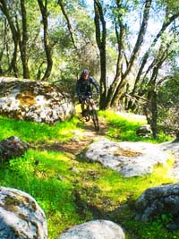
Singletrack rolling along the Greenhorn foothills above the Kern River.
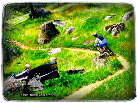
Feeling the flow on the Kern Canyon Trail. |

THE STATS
From Delonegha Bridge:
* 5.2 Miles to Badger Gap Trail
* 1000+ feet of climbing
From Keyesville to Delonegha:
*21 Miles One-Way.
*2800 feet of climbing.
*3500 feet of drop.
Freeway Ridge TH to Delonegha:
*12 Miles One-Way.
*1600 feet of climbing.
*2200 feet of drop. |
UPDATE: April 2025:
The trail has been riding well with moist dirt after some of the rain showers. A couple trees are down. Many of the usual wildflowers are out, but are starting to drown in the taller grass. So far the cows are not affecting the trail too much! Watch out for a large number of hikers near the Delonegha Bridge!
|
 |
 |
 |
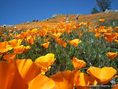
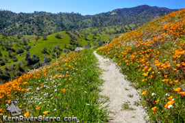
| The 2019 Spring Superbloom as seen from the trail! |
On the trail...
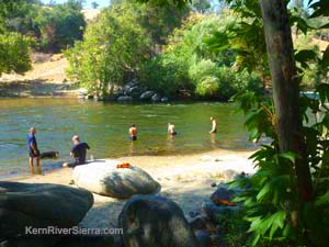  |
Jumping in the lower Kern River after a
hot summer ride.
|
 |
A ribbonous reward after a stout climb.
|
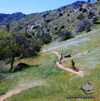
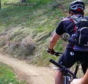
With over 20 miles of fast, flowy, smooth singletrack, the Kern Canyon Trail makes for an awesome cross country ride.
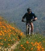 |
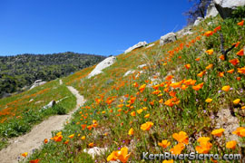
| Spring wildflowers lining the singletrack. |
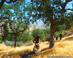
While enjoying vast mountain views and occasional glimpses of the river, riders will pass some small creeks, meadows and oak groves along this rolling trail.
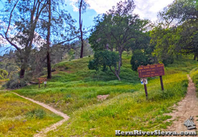
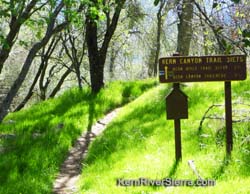
Delonegha Bridge Trailhead
Since this is the lower trailhead (southwest) and closest to Bakersfield, the Delonegha Bridge Trailhead sees a lot of bike traffic. This section of trail is almost completely smooth and very well maintained. At about a 3% grade, it's well designed for both climbing and descending.
Note that the lower section of this trail is named Kern River Trail, which continues to the southwest.
Climbing to the lush intersection with Badger Gap Trail at Delonegha Creek makes for a 10+ mile ride. Many riders continue on up Badger Gap Trail or stay on Kern Canyon Trail for longer rides. Afterwards, cool off in the Kern River right at the trailhead!
 |
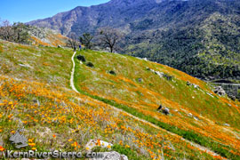 |
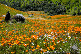
| The lower section of the ride often has some of the best wildflower-covered slopes anywhere! |
The Ride from Keyesville
Although there are several variations of the ride, one epic ride starts from Keyesville (Near Lake Isabella) and roughly contours the rolling oak-covered mountains above the lower Kern River to Delonegha Bridge on Hwy 178.
 |
 |
| Fall Riding.At the top of the long climb after
the Freeway Bridge Trailhead. |
Riding in reverse - back to Keyesville. |
Even though many people shuttle this ride, it is not a downhill ride whatsoever. Several climbs throughout the ride will certainly get the quads burning and the heart pumping; this is a cross country ride and it requires some effort!
 |
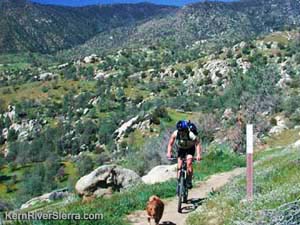
Near the Badger Gap Trail split & rest area. |
The ride begins on a section of the Keyesville Classic XC race course and then splits
off to contour the foothills of the Greenhorn Mountains for the next 21 miles. Most of the ride is smooth singletrack with lots of ups and downs, and ends with a nice rolling descent.
If you shuttle (highly recommended) you'll climb a demanding 2800 feet up and drop 3400. Despite the shuttle, keep in mind that this is a very pedally cross-country ride.
Freeway Ridge Trailhead
For those wanting a shorter ride, the Freeway Ridge Trailhead is a great option and a popular place to start a quality 12 mile ride to Delonegha Bridge or Badger Gap Trail. Some of the best and most fun singletrack is found in this second half of the trail. One can also ride back northeast toward Keyesville for another great option.
When to go
|
Jumping in the lower Kern River after a
hot summer ride.
|
While the trail is ridden year round, some seasons are far more enjoyable.
Kern Canyon Trail goes off in the spring! The dirt is epic, grass green with wildflowers scattered throughout.
The trail also sees a lot of mountain bike traffic in the winter, and the trail conditions are usually good.
Although the trail is still ridden, Summer and Fall can be very hot and exposed. The trail conditions can change for the worse if the cows have been tramping around the drier dirt. And sometimes they leave fresh brown goodies to steam up the trail.
Watch out for both cows and weekend dirt bikers!
Note: Some photos and descriptions are adapted from The Mud Blog.
Mega Rides, Bikepacking, E-biking
Use your imagination!
All of these singletrack trails link up: Kern River Trail, Kern Canyon Trail, Badger Gap Trail, Oak Flat Trail, Keyesville Classic, Dutch Flat Trail, Rocky Gulch Trail, Wagy Ridge Trail, Just Outstanding Trail, Unal Trail, Portuguese Trail, Tobias Creek Trail, etc!!!
Elevation Profile for lower Kern Canyon Trail (from Freeway Ridge)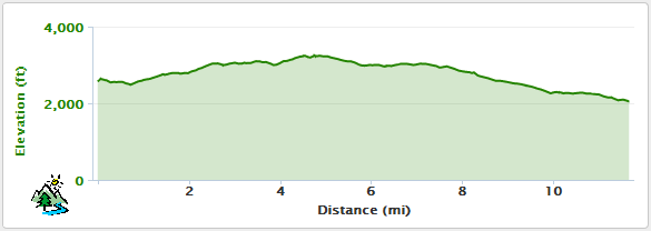
 |
 |
March trail conditions!
So Green! At the Badger Gap Trail intersection.
|
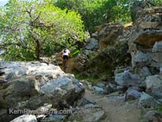
Riding through the limestone above the gigantic Greenhorn Creek cave complex. |
Trailhead
Kern Canyon Trail is close to Lake Isabella and about 15 minutes south of Kernville.
Delonegha Bridge Lower Trailhead:
If you are driving from Bakersfield, the Delonegha Bridge Parking area is 22 miles up canyon from the HWY 184/178 junction. After Hwy 178 widens into a 4-lane freeway, watch for the parking turnoff on the right just before the bridge.
From Lake Isabella, drive southwest on the 178 about 10 miles. Just beyond the bridge, turn right and drive down to the river.
Park at the large parking area by the river. The trail is on the other side of the river, so you have to do a little scrambling and cross the bridge.
 |
| Lookout for snakes in the summer! |
Keysville:
The Keysville entrance is located just north of the town of Lake Isabella. From Hwy 155, go west on Keyesville Road. Drive almost .7 miles and park on the left in the large dirt open area near the restrooms. This is known at the main Keyesville Staging Area. Follow the directions to the Keysville Classic, and turn RIGHT onto Kern Canyon Trail approximately 3.5 miles from the staging area.
Freeway Bridge Trailhead:
The trailhead parking is on the north side of the 178 at Freeway Ridge 4X4 Road. Look for a dirt parking area with an unlocked gate about 3 miles southwest of Borel Road or 4.5 miles northeast of the Delonegha Bridge.
From the parking area head up the 4x4 road for a couple hundred feet and turn left on the Kern Canyon Trail.
Nearby Activities
|

