After a few steep climbs, this trail barrells down toward the Kern River.
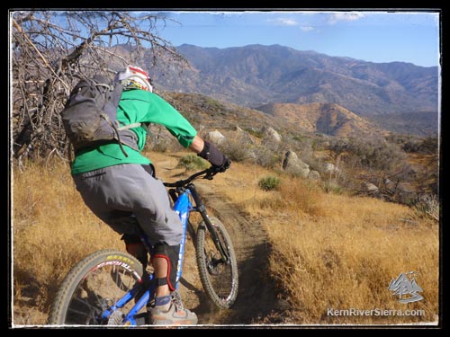
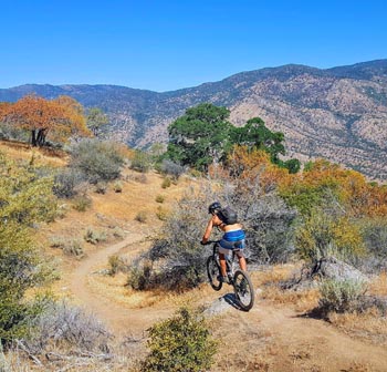
Feeling the groove on Remington Ridge. |

THE STATS
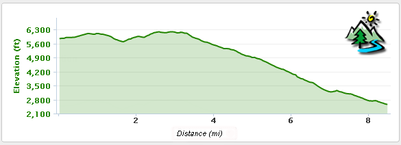
- 600+ feet of climbing
- 4100+ feet of drop
- Shuttle Ride
- (can be ridden uphill)
- Motorized Multi-Use Trail
- Top Elevation: 6000 ft
- Lower Elevation: 2500 ft
- Sequoia National Forest
- Access: Haviliah, Lake Isabella
- Map: Kern River Sierra Outdoor Recreation Map, 6th
UPDATE, May 16, 2025: The trail needs lots of love and work after the 2024 Borel Fire. A few dirt bikes have been charging through, but its not recommended for biking at this point. (At least in the upper sections) |
The Ride
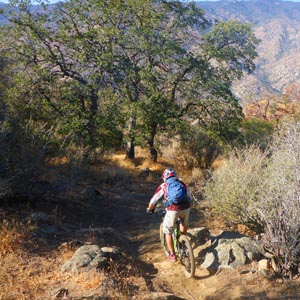
Remington Ridge Trail, A.K.A. "Hobo Ridge," makes an exciting mountain bike ride. After some climbing at the beginning, it transforms into super sick downhill with incredible views from Lake Isabella to the highest of Sierra Peaks. Even though its in close proximity to Mill Creek Trail, it has completley terrain and scenery. While there are some incredible sections of flow, it is splattered with several technical and tricky boulder sections that check your speed.
 |
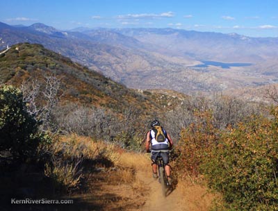 |
| Almost 4,000 feet of descent left! |
Several views of Lake Isabella and the High Sierra appear throughout the ride. |
The ride actually starts at "Lightners Flat" out on Breckenridge Road, and follows dirt roads out to the trailhead. After some climbing and descending, the old road reaches steeply attains the actual trailhead. The short steep climbs and descents continue (with some hike-a-bike for most) past a false summit and to the beginning of the descent. At this point, its a pure shredfest of rugged downhill fun.
 |
| Carving brown pow. |
Like Mill Creek Trail, this singletrack is open to motorcycle use. While you'll notice evidence of them, its unlikely to see one.
At the bottom of the trail, there are usually plenty of old motorhomes and camper vans parked about. They are there for the excellent (but often crowded) river side Remington Hotsprings.
Shuttling
This ride requires a fairly long shuttle, although is a bit shorter than Mill Creek Trail. Its best to find a shuttle driver to take you up to do both trails.
Elevation Profile from Breckenridge Rd
Trailhead
 |
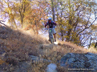
| Shred it! |
The lower trailhead:
Take Highway 178 southwest from Lake Isabella about 14+ miles to Kern Canyon Road near the Democrat Fire Station. The trailhead is located 1.5 miles up the Kern Canyon Road.
The upper trailhead:
If you dropped a shuttle vehicle, return north on Hwy 178 and take the Bodfish exit #42. Turn Right on Lake Isabella Road, which will turn into Bodfish road. Drive 2.3 miles past the small historic town of Havilah, and go right on Breckenridge Road. Take this for about 9 miles, passing Lightners Flat (where Remington Ridge Trail starts). The signed trailhead is off the dirt road on the right near Squirrel Meadow. Start riding the dirt road up a little hill to the actual trailhead.
 |
 |
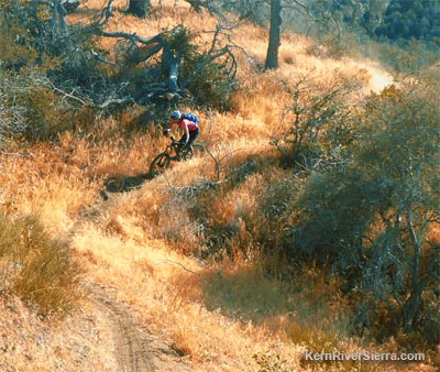
| An excellent flowy section of trail near the bottom. |
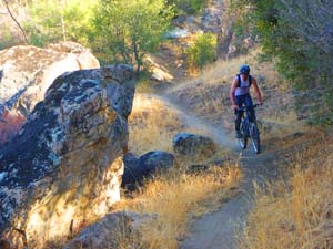
Entering a fun technical section in the oaks. |
|

