One of the longest, smoothest, and most continuous mountain bike singletracks in the Southern Sierra!
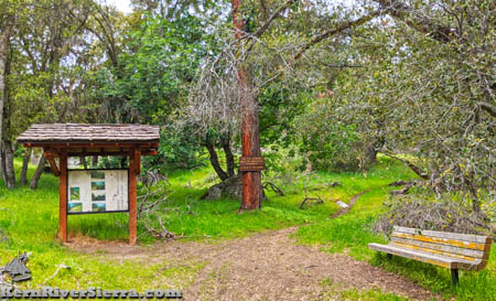
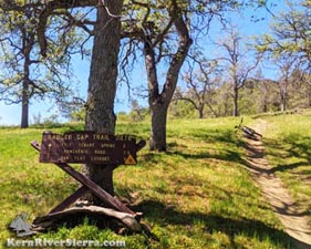
Badger Gap Trail in the Spring. |

THE STATS
- Type: Smooth Singletrack
- Miles: 12.4 (1-way on 31E76)
- D. Bridge to Rancheria Rd: 17.5 mi (1-way)
- D. Bridge to Troughs/31E51: 20+ mi (r/t)
- Ride: Out 'n' Back. Loop or Shuttle possible.
- Motorized Multi-Use Trail
- E-Bike friendly
- Elevation: Top TH:4200 ft. Lower TH: 3000 ft. D. Bridge TH: 2050 ft
- Ride Gain/Loss: 3200 ft (D. Bridge to Troughs)
- When: Winter & Spring are best
- Were: Greenhorn Mountains, Lower Kern River
- Access: Hwy 178/Delonegha Bridge, Rancheria Rd
- Town: Lake Isabella
- Land: Sequoia National Forest
- Map: Kern River Sierra Outdoor Recreation Map, 6th
UPDATE: May 2026. Great news! Stewards of the Sequoia just spent a few days clearing on the upper Badger Gap Trail! It's been brushed over for years. The lower section up to the "Blue Tanks" was riding well all this spring with the help of mtb volunteers. It's dried out significantly with tall grass in places. |
Badger Gap Trail
Connecting the Greenhorn Mountains near Oak Flat Lookout to the Kern Canyon Trail, Kern River Trail, and the lower Kern River, this smooth singletrack is an important segment in the Greenhorn trail network.
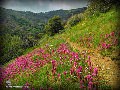 |
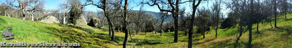
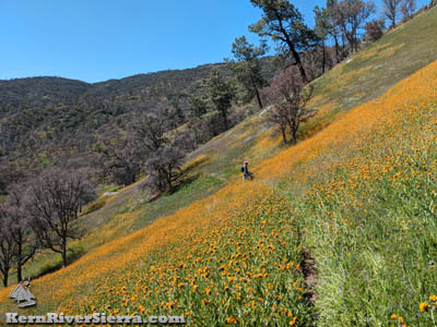
Badger Gap Trail in during a Wildflower Superbloom. |
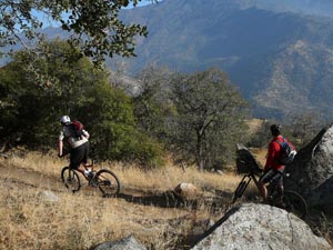
Built with Green Sticker OHV funds, this multi-use motorized trail is very popular with mountain bikers in the spring especially.
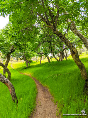
Besides providing a fun workout, the Badger Gap trail delights with lush green ravines and splatters of wild flowers through the oak and buckeye studded hills.
With a few ride variations available (see below), the most popular ride commences at the Delonegha Bridge on the Kern River and first ascends Kern Canyon Trail to the Badger Gap Trailhead Bench and on to the water troughs at the intersection with Trail 31E51.
The Ride
The primary trailhead for Badger Gap is at Delonegha Bridge on Hwy 178. Initially the ride follows the signed Kern River Trail, 32E49, to the north which soon turns into the Kern Canyon Trail, 31E75.
After pedalling up the gradual and pleasant Kern Canyon Trail (see description here) just over 5 miles and 1000 ft in elevation, the rider comes to a welcome rest spot at the Badger Gap Trailhead intersection. This well signed and shady green area near Delonegha Creek is known as "The Bench."
From this point, the trail continues to climb in and out of moist ravines loaded with miners lettuce and exposed hillsides with large views of the surrounding mountains.
After some more climbing, the trail reaches its next intersection with Woodpecker Trail, 31E51 at the "Water Troughs," which are blue plastic water tanks for cows. Many bikers turn around here, after about 3,000 feet of climbing in 10 miles.
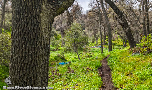 |
| The lush area at the blue water troughs at Badger Gap, and the intersection with 31E51. This popular destination for many mountain bikers, is loaded with Miner's Lettuce all spring. |
Badger Gap Trail continues just below the blue tanks; look for the tight singletrack lined with very thick beds of miners lettuce. The trail now descends briefly (almost 400 feet in elevation) before reaching another intersection at the top of Kern River Trail, 32E49, in about 2.8 miles. Occasionally mountain bikers will take this to create a loop (see below). NOTE! Don't miss this intersection. Its easy to turn left and miss the continuing Badger Gap Trail.
 |
 |
| In the midst of a Fall shuttle ride. |
The ride is well signed! |
Badger Gap Trail resumes climbing and contouring up past Little Tenant Spring and skirts narrowly along the edge of some steep ravines in places. After passing through a pleasant park-like setting, the trail eventually reaches Oak Flat Lookout Trail, 31E79, and Rancheria Road. The top is about 17.5 miles from Delonegha Bridge. The full out 'n' back ride would be roughly 35 miles with 5,000+ feet of elevation gain/loss.
If that's not enough, mountain bikers can continue on Oak Flat Lookout Trail and ride to the tower to gaze upon the large swath of terrain just ridden!
 |
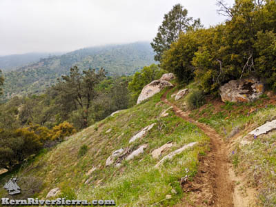
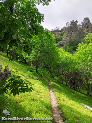
| The upper stretches of Badger Gap Trail, near the Oak Flat Trail. |
Ride Options
Out 'n' Back Rides
As described above, riding to the Water Troughs is roughly 20 miles with 3200 ft of climbing.
 |
Winter riding. |
Riding all the way to Oak Flat Lookout Trail/Rancheria Road makes for a giant ride of 35 miles with 5,000 ft of elevation gain. At this point, one might as well continue further to the Oak Flat Lookout.
Another variation is to ride from Freeway Ridge Trailhead or even further from Keyesville on Kern Canyon Trail.
Loop Ride with KRT
To ride a loop, take Kern River Trail north to Kern Canyon Trail to Badger Gap Trail. The high point of the ride is near the water troughs. Descend the next section of Badger Gap trail and ride out to the upper intersection of Kern River Trail. The Trail steeply descends toward the Kern River and then turns and rolls up and down on its way back to Delonegha Bridge.
 |
Traversing the hill slopes past the water troughs. |
Shuttle Rides
Most people who do the long shuttle, start at the Just Outstanding Trailhead. After taking the top section of trail, bike along Rancheria Road all the way to the Badger Gap Trailhead. Enjoy the long gradual descent on Badger Gap, but remember that there is a climb in the middle of it! The ride ends at Delonegha Bridge after about 36 miles.
Another option is to shuttle up Rancheria Road from Bakersfield about 15 miles to Oak Flat Lookout parking. Take Oak Flat Trail down to Badger Gap Trail to Delonegha Bridge for a great 20 mile ride.
Remember that both options involve dropping a car at the bottom!
Mega Rides, Bikepacking, E-biking
Use your imagination!
All of these singletrack trails link up: Kern River Trail, Kern Canyon Trail, Badger Gap Trail, Oak Flat Trail, Keysville Classic, Dutch Flat Trail, Vista del Lago Trail, Rocky Gulch Trail, Wagy Ridge Trail, Just Outstanding Trail, Unal Trail, Portuguese Trail, Tobias Creek Trail, etc!!!
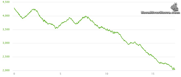
Elevation Profile for Badge Gap Trail (including KCT to Delonegha)
 |
Badger Gap Trail after spring rain. |
Trailhead
Kern Canyon Trail is close to Lake Isabella and about 20 minutes south of Kernville.
Delonegha Bridge Trailhead:
If you are driving from Bakersfield, the Delonegha Bridge Parking area is 22 miles up canyon from the HWY 184/178 junction. After Hwy 178 widens into a 4-lane freeway, watch for the parking turnoff on the right just before the bridge.
From Lake Isabella, drive southwest on the 178 about 10 miles. Just beyond the bridge, turn right and drive down to the river.
Park at the large parking area by the river. The trail is on the other side of the river, so you have to do a little scrambling and cross the bridge.
Nearby Activities
|