The Loop is super fun right now with great conditions! All clear and great dirt!
2020 - There is a new segment near the mine shaft that bypasses 2 nasty climbs (see photo on left), and the newer section near the end that winds its way through the old Pearl Harbor monument area. Most bikers are missing this trail! [Look just after the super fun section that squeezes through some boulders and banks its way down toward Pearl Harbor Drive. The new trail ascends the hill on the left and adds a couple more miles of singletrack!]
Keyesville Recreation Area
Keyesville Recreation Area offers year-round bike riding, with superb conditions in the winter and spring. The Keyesville Classic Mountain Bike Stage Race takes place here in late March every year. While its a grassroots-style event, it has attracted many of the best mountain bikers in the USA. It also hosts one of the biggest races in California - the High School Championships. In 2019, nearly 1,000 racers participated.
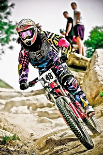
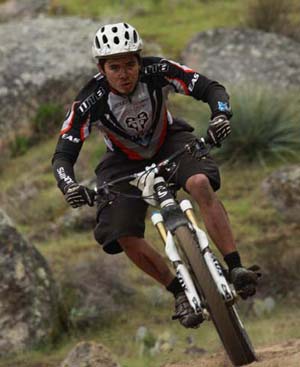
WTB World Cup Enduro Rider, Ben Cruz.
Eye of the tiger. Photo: Mike Lane/Sierra Images.
On The Trail
There are a myriad of options for riding in Keyesville. Various motorcycle trails and narrow dirt roads criss cross all over the place. The BLM is in the process of forming a new Resource Management Plan, so some of the options may change.
The race course loop involves trails and dirt road on both sides of the paved Keyesville Road. The shortest possible loop that incorporates all the good singletrack will be briefly described below.
The main Keyesville Loop:
The first part of the ride is the most confusing to find/describe. There are several ways to the main singletrack, which has a fence-constriction to keep ATV's out. This is the most common and simplest way:
Start from the main Keyesville Staging Area by the restrooms, .7 miles down Keyesville Road from Hwy 155. Begin riding southwest up the paved Keyesville Road. (Note that some bikers park at the 155 parking area and take the paralleling motorcycle trail up to the staging area.)
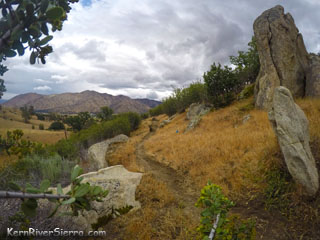
Tacky soil on the Keyesville Classic Trail in the Winter.
After passing Pearl Harbor Drive, one may stay on the paved road or look for an alternate singletrack just over on the left, which is utilized by the California High School championship races.
Ride by a couple minor trails/roads on the left, and at about .7 miles (from the staging area) turn left onto a main dirt road and climb up to a major intersection. Turn right on the road (it is signed Keyesville Classic), and climb a little more. Look for the trail that drops down to the left; take this! Soon you'll be at another dirt road, turn right. You'll pass the very rough and narrow Tombstone 4x4 road, where one of the Keyesville Downhill Courses was located.
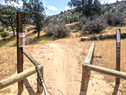
At about 1.6 miles from the Staging Area, the dirt road constricts into a motorcycle singletrack. There is a new barrier to keep ATV's out! Feel some flow here!
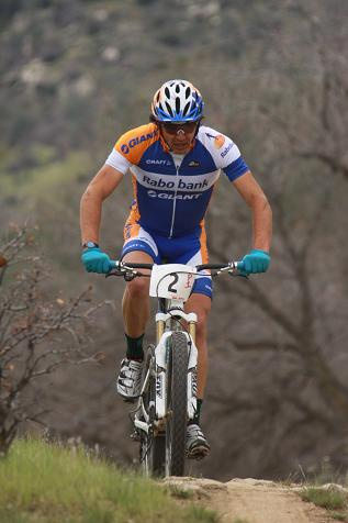
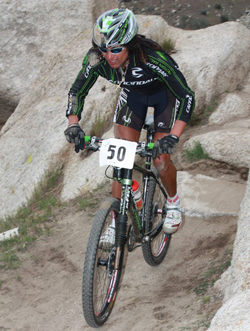
2X Olympian, multiple time National Champion, and mountain bike legend, Tinker Juarez, riding in 2011.
Look for the new bypass trail just pass the mineshaft on the right (at 1.9 miles). Take this excellent 3/4 mile trail to avoid the 2 worst climbs on the original ride.
After the trail reemerges with the original trail, there are a series of short climbs before the longest continuous downhill section starts.
Almost immediately the trail splits at Kern Canyon Trail; stay left for the Keyesville Classic return route (you are actually on the upper Kern Canyon Trail for this segment). (Turning right takes you on the much bigger Kern Canyon Trail ride, or to an alternate variation "White Rock Loop" that climbs back up a dirt road leading back to the Keyesville Road and the top of Tombstone.)
At roughly 4.6 miles from the staging area, veer left at a split before dropping into a gully. This is a more recent piece of the Keyesville Classic singletrack, known as the "Lower Pearl Harbor section". For the most part, it climbs its way up some oak-studded hills. Pass a connector trail on the left that is used in the High School Races.
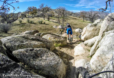
After about 1.3 miles on this trail segment, it drops through some boulders into a super fun slalom section as it approaches Pearl Harbor Drive. Where the trail starts to parallel the road, veer left up a bank and look the brand new singletrack known as the "Upper Pearl Harbor section." (In 2019 it is very faint in the first 30 feet.)
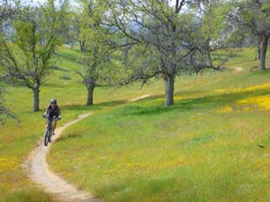
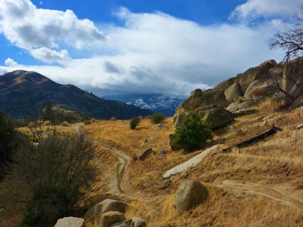
On the Pearl Harbor section of trail.
This trail undulates up and down as it crosses a few roads and the area where the old Pearl Harbor Monument used to be. After about 1.3 miles it ends at another ATV barrier/constriction. Go right on this atv road; and keep your speed up for a few fun jumps in here. Stay straight, climb a little hill, and continue on this until it wraps back around to Pearl Harbor Drive.
Veer left onto Pearl Harbor Drive and look for the continuation of the trail to the right. This will bring you back to Keyesville Road, where you can keep riding on the other side or ride back to the staging area.
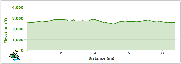
Elevation Profile
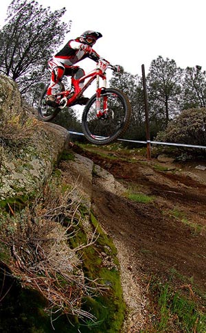
Tombstone Downhill Race at Keyesville.
Photo by Scott Ferris, 2011.
Ride Options
Keyesville Classic Race Course: This also includes some of the dirt roads on the north side of the paved road for a slightly longer ride.
Tombstone/Rocky Gorge Loop Option: At the beginning of the ride, keep pedalling up Keyesville Road to the saddle. Descend Tombstone or Rocky Gorge (technical steep narrow 4x4 roads) and merge back into the Keyesville Classic.
Snake Pit Option: Cross the road from the Staging area and make your way over to Dutch Flat 4x4 road. Climb this to the intersection with Snake Pit. Go right and test yourself in a great technical section; the highlight of the downhill course. Another more adventurous addition is to take the seldomly used Vista Del Lago Trail, which connects to the Dutch Flat/Snake Pit area.
White Rock Loop: Take the Keyesville Classic route, but turn LEFT on Kern Canyon Trail. Continue until you see road 27S30 on the right. Take this to climb back up to the saddle on Keyesville Road, where you can take Tombstone or other variations back down.
Kid Shuttles: Families can use Pearl Harbor Drive to shorten sections of the trail.
Kern Canyon Trail: Set up a shuttle and keep going all the way. Note that this is a demanding XC ride.
New barriers have been installed throughout the Keyesville Classic Trail to keep it singletrack. Thanks to Stewards of the Sequoia.
Keyesville is located between Wofford Heights and Lake Isabella.
The Keyesville entrance is located just north of the town of Lake Isabella. From Hwy 155, go west on Keyesville Road. Drive almost .7 miles and park on the left in the large dirt open area near the restrooms. This is known at the main Keyesville Staging Area.
The bottom of Dutch Flat Trail (and Snakepit Trail) are on the other side of Keyesville Road. The Keyesville Classic Race Venue is farther up the Keyesville Road and off a dirt road to the right.
Following Keyesville Road for 1.5 miles will take you to the top of Rocky Gorge/Tombstone Ridge, which descends back down to the Keyesville Classic Loop.
Dont Get Lost!
The Keyesville, Kern Canyon Trails, etc are depicted on the local adventure map:


 2X Olympian, multiple time National Champion, and mountain bike legend,