A forested trail to a peak with grand views of the Southern Sierra.
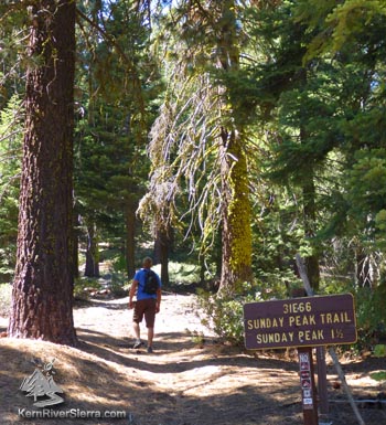
At the Sunday Peak Trailhead.
|
THE STATS
- 3.4 miles total.
-
1100 feet of climbing.
- Up & back trail.
- Summit: 8295 feet.
- Greenhorn Mountains near Alta Sierra.
- Sequoia National Monument
- Map: Kern River Sierra Outdoor Rec Map
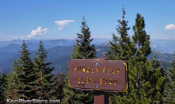 |
| The sign lets you know you are at the top. |
|
Update after the 2021 wildfires
June 2022: Sunday Peak trail has reopened after the 2021 French and Windy fires. As of early June, the trail had not been officially maintained but people are hiking it again!
Fall 2016: Unfortunately this area burned in the Cedar Fire. It will take some time before it gets some color back, but the peak views are probably better than ever.
The Sunday Peak Hike
This superb summer hike climbs under a forested canopy of incense cedar, pine, and red fir in the Greenhorn Mountains near Portuguese Pass. When the canopy opens to the sunshine and vistas, the trail is already above 8,000 feet in elevation.
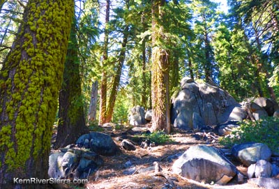 |
Gorgeous moss-lined trees and granite boulders
line the trail. |
Because of the vast expanse of terrain visible, this peak used to have a US Forest Service Lookout tower. After being replaced by the tower at Tobias Peak, it was destroyed in the 1950's and has returned to its natural state.
Sunday Peak is on the Sierra Club's 'Hundred Peaks Section' Peak List.
On the trail
The trailhead is at an intersection with the Portuguese Pass Trail, Portuguese Pass Road, and a random dirt road. Look up the slope beyond a small parking area, and spot the trail climbing steeply at first.
It climbs through the shady forest, and crosses into the Sequoia National Monument in 2/3 mile.
At 1 1/3 mile, there is a split in the trail. Go left to reach the peak.
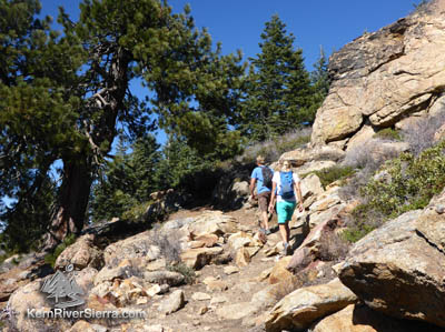 |
Almost to the top! |
(To the right, the telephone ridge trail veers left and descends a ridge.) This is the way to reach the granite studded Bohna Peak and the related trail, which eventually cuts off to the south at a small peak. For confirmation, look for the small signs posted on the trees.
When the trail exits the forest and climbs the granite talus, you are near the top. At 1.7 miles, the hike reaches the peak! Enjoy the views and dont forget to check out the register.
Numerous remote peaks and valleys are on display. The rugged Kern Plateau fills up the eastern view, while The Needles and the giant mountains of the High Sierra are to the north.
Options
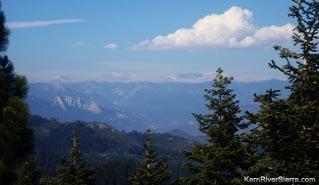 |
The Needles and the peaks of
Sequoia National Park. |
For more mileage, hike a section of the Portuguese Pass Trail. Note that this is popular with motorcycles and mountain bikers, especially on weekends.
Also, nearby are the North Portuguese Pass and Bull Run Peak Trails.
Nearby Trails
The trails, mountains, climbing spots, and nearby activities are depicted on the Kern River Sierra Outdoor Recreation Map, 6th ed.
Trailhead
Drive to Wofford Heights and take HWY 155 up to Greenhorn Summit. Turn right on the dirt road, 24S15/Portuguese Pass Road. Take this almost 6 miles, until you see a large sign for Sunday Peak Trail.
The dirt road on the left leads to a small hidden parking area just below the trail. |
