Secluded, scenic, quality climbing on the border of Domeland Wilderness.
 The Church Dome(s). The Church Dome(s).
|
- Approach: 1.3 mi
- Elevation: 8000 ft
- Sport Climbing, Trad Climbing
- 5.7 to 5.11
- 1-2 Pitches
- Land: Sequoia National Forest
- Borders Domeland Wilderness
- Where: Southern Kern Plateau
- Access: Cherry Hill Rd
- Town: Kernville
- Map: Kern River Sierra Outdoor Rec Map
- Hiking Description
|
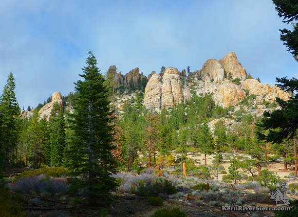
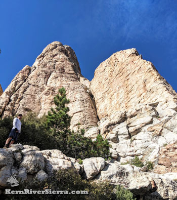
Climbing Church Dome
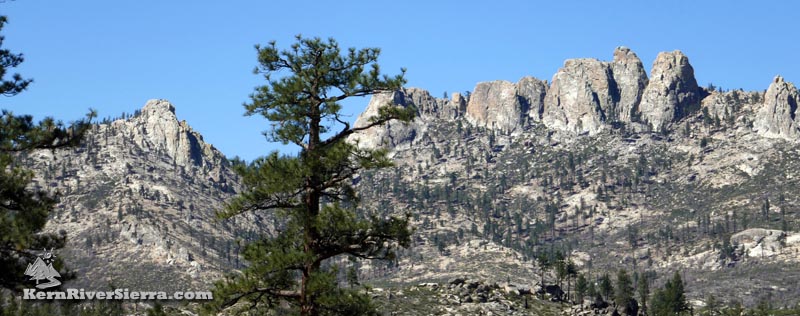
On the edge of Domelands Wilderness, the Church Domes provide days of quality climbing in a very remote setting.
View from the West.
|
Many of the routes are described in the older guidebook: Southern Sierra Rock Climbing: Domelands. More info coming soon!
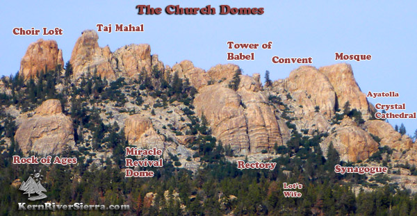
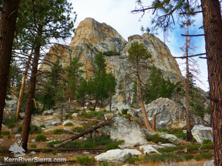
Looking up at the walls of Ayatolla
and the Mosque. Several routes are in view, ranging from 5.7 -5.10+.
|
How to find it
Church Dome is accessed from Woodpecker Trail, 34E08, near Taylor Meadow on the southern Kern Plateau. (It can also be reached from Manter Meadow in Domeland Wilderness.)
Find a full description and photos of the Church Dome hike here.
Directions
Drive north from Kernville on the Mtn 99 and turn right at Sherman Pass Road (22S05), Just before the Johnsondale Bridge. After about 6 miles, turn right onto Cherry Hill Road (22S12) and drive past Big Meadow and stay left near Long Meadow (20+ miles). Next turn left on a dirt road 24S13. As you reach the end near Taylor meadow, spot the trailhead sign on the right. The trailhead (Woodpecker/Domelands) is about 53 miles from Kernville.
The Woodpecker Trail (34E08) continues through much of Domeland Wilderness. To reach the Domes, take the trail up about 1.3 miles.
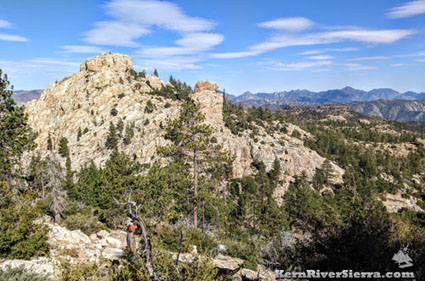 |
| Looking east of the trail, to the "Temple of Doom," which holds some 5.12 routes. |
The east faces of the "Convent," "Mosque" & "Ayatolla" as seen from the trail.
|
|
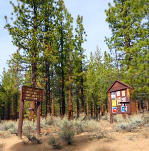
Church Dome / Woodpecker
Trailhead near Taylor Meadow.
|
Nearby Climbing
Other Nearby Activities
|