A remote hike to the edge of the Kern Plateau near Horse Meadow.
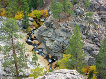
Looking at the Salmon Creek Teacups from just above Salmon Creek Falls.
|
THE STATS
- Miles: 4.6+ mi total; 8.7 miles hike from Horse Meadow
-
Elevation Gain/Loss: 900 ft
- Hike: Up & back
- Trail: Non-Motorized Multi-Use, mountain bike allowed
- Elevation: Horse Meadow Trailhead 3600 ft; Upper Falls: 6300
- Land: Sequoia National Forest
- Where: Kern Plateau/Horse Meadow
- Access: Kernville, Kennedy Meadows
- Explore: Swimming Holes, Fishing, Rock Climbing, Camping, BikePacking
- Map: Kern River Sierra Outdoor Rec Map
|
The Hike
 |
The Trailhead. |
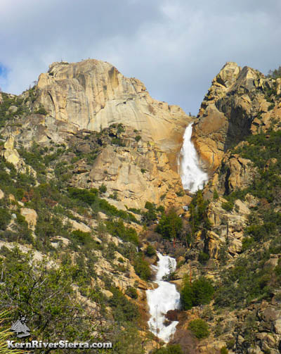
Near Horse Meadow, Salmon Creek flows through lushly vegetated forest and granite slides and pools and then suddenly drops off the edge of the Kern Plateau. After a series of breathtaking waterfalls, including the highest in the Southern Sierras, it merges with the Kern River.
A pleasant hike through the forest above the banks of Salmon Creek, leads to the trail's end where the terrain steepens. At this point, there are plenty of adventurous options. Some hikers may want to simply enjoy the sounds of the rushing water and the framed views across to Baker Point. Those with strong scrambling and rock climbing skills could climb the granite hill to the right (north) to get a view of Upper Salmon Creek Falls. Fisherman and swimmers (only at very low flow!) can scramble down to the left (south) to the teacups.
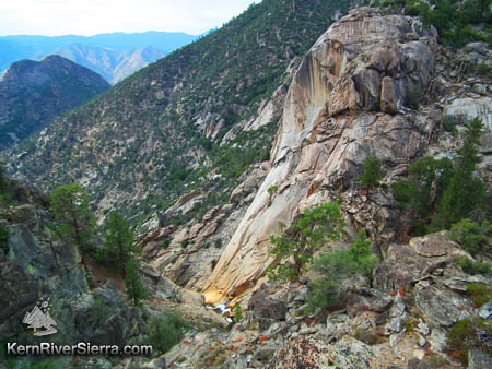 |
Near the top of Salmon Creek Falls. Viewing from a primitive campsite on an old trail above creek left. |
The Details
One can hike the trails from Horse Meadow, which are wonderful; or start at the official trailhead.
From the main USFS trailhead:
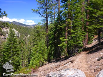
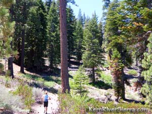
During the first mile of the hike, the trail traverses a pine and fir forest above the Salmon Creek Canyon. At one point, it climbs before very steeply descending down toward the creek. If you happened to notice passing a fainter trail that follows a gully; this is an easier way. However, its not maintained.
 |
 |
Where the trail ends, but the
adventure continues. |
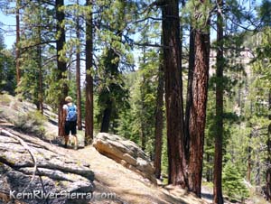
Hiking the forested 2.3 mile section of trail. |
After crossing the creek, enjoy the nice pine-needle padded trail along the creek. As the trail sees more and more sun, it will start to climb up to the viewpoint and trail terminus. Some cairns help along the way.
As mentioned above, there are several options to explore the area and enjoy the scenery.
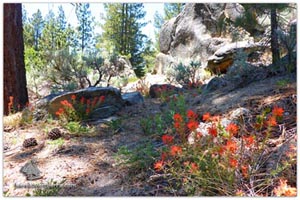 |
Some of the delights of the trail. |
In the spring the water flows are the highest, but the low summer flows are perfect for lounging in the small teacup pools.
According to J.C. Jenkins "Self Propelled in the Southern Sierra," Salmon Creek Falls is the highest waterfall in the southern sierra.
This Yosemitesque creek has inspired adventure and exploration for years See Canyoneering here. See Wild Route here for the best view of the Upper Falls. See also Rock Climbing Salmon Creek Wall.
 |
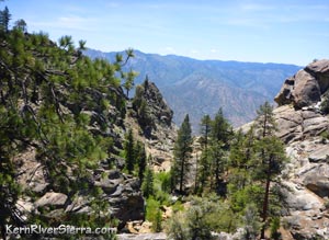
The trail above the Salmon Creek canyon.
Looking east to the crags above Horse Mdw. |
Nearby Activities
Several other trails are nearby including:
Great rock climbing, bouldering, and mountain biking also abounds in this area.
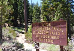
Trailhead
The trailhead is off Cherry Hill Road north of Kernville.
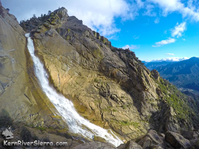 |
Upper Salmon Creek Falls. |
Salmon Creek Falls Trailhead: From Kernville, drive north about 19 miles on Mtn 99, and turn right on Sherman Pass Road, 22S05. Drive up this and turn right on paved Cherry Hill Road, 22S12, and drive for 9.6 miles. Pass the road to Horse Meadow Campground and the Deadwood Trail, and then turn right on dirt road 23S08. Take this 4 miles. There is a dirt parking area at the end of the dirt road, near the Salmon Creek Falls Trail sign.
Horse Meadow Campground Trailhead: Follow the same directions above, except turn right on Horse Meadow Road. Descend just over a mile to the campground area, and park below the campground off a righthand turn. There is a restroom and a trail sign, although the trail is fairly faint/lower use in this area. The trail adds about 4 miles to the described hike.
| |
Salmon Creek Falls Trail. |
|