Hike into Golden Trout Wilderness to the Wild & Scenic Little Kern River, just before it plunges down to the Kern River Canyon from either Jerkey Meadows or Lewis Camp Trailheads.
Hiking to the canyon downstream of the Little Kern River Bridge. |
THE STATS
- Jerkey Mdws TH Miles :
11+ total
- Elevation Gain/Loss: 2150 ft
- Elevation Range:
6925 ft-5700 ft
- Lewis Camp TH Miles :
8.5+ total
- Elevation Gain/Loss: 1950 ft
- Elevation Range:
7700 ft-5700 ft
- Hike: Up & back
- Tread: Wilderness Trails
- Fishing: Excellent!
- Land: Golden Trout Wilderness
- Trailhead: Lewis Camp or Jerkey Meadows Trailhead
- Highlights: Hiking, Fly Fishing, Swimming, Canyoneering
- Note: Avoid river in spring.
- Map: Kern River Sierra Outdoor Recreation Map, 6th
|
Trail Acess Update!
June 1, 2023: Lloyd Meadow Road is still closed due to winter storm damage. Hopefully it opens soon!
June 2022: The Jerkey Meadows Trailhead is finally open after the recent fires. We are net yet sure of the condition of the trails, but will update when we know. The Forks of the Kern Trail and Blackrock Trailhead are also open. Lewis Camp and several other Golden Trout Wilderness Trailheads are still closed for the year.
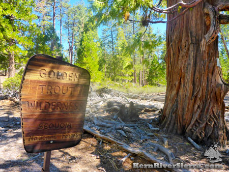 |
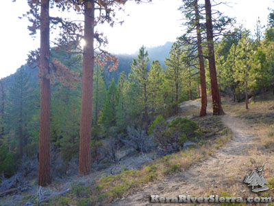
| Golden Trout Wilderness starts here! |
Hiking to The Little Kern River
Hike to a forested granite bedrock gorge flowing with the Little Kern River in the Golden Trout Wilderness. After encountering meadows and open forest with Jeffrey Pines, fir, willows, dogwood, the river provides wonderful swimming pools filled with Golden Trout. It's like peering into fly-fishing heaven.
The Little Kern Bridge is also the gateway to several longer hikes or many backpacking options.
This day hike is so great that it comes with 2 different trailheads!
Both the Lewis Camp Trailhead (off North Road, off the Western Divide Hwy) and Jerkey Meadows Trailhead (off Lloyd Meadows Rd near Johnsondale) lead to the bridge.
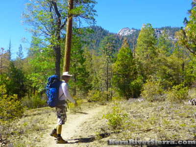 |
Happy Hiker near the Jerkey Meadows TH. |
On the Trail
Lewis Camp Trailhead is almost 1800 feet higher in elevation than the Jerkey Meadows Trailhead, and commences with a shorter downhill hike. However after the return trip, it only saves about 200 feet in cumulative elevation gain by the end of the hike.
Lewis Camp Trailhead: From the trailhead, take Lewis Camp Trail, 33E01. After a little more than a mile, the Fish Creek Trail, 32E12, intersects at 6925 ft. Stay on the Lewis Camp Trail which heads north east overall.
Jerkey Meadows Trailhead: At 5930 feet, this trailhead provides access to Fish Creek Trail, 32E12. Take this as it passes a fork of Lloyd Meadow Creek and then steadily climbs 1000 feet through a pleasant forest between the prominent Hermit Spire and Castle Rock. After over 2 miles, turn right onto Lewis Camp Trail, 33E01, near the high point of the hike.
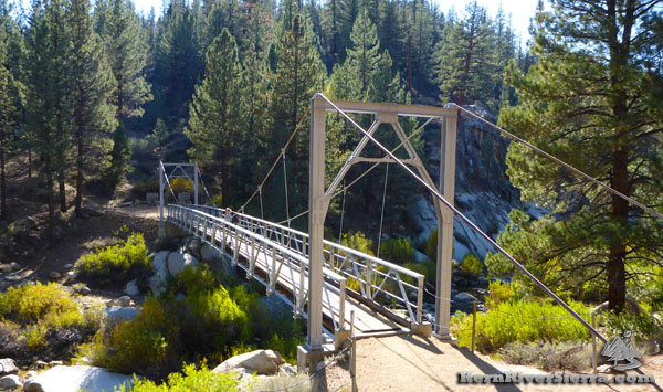 |
| Hiker on the bridge spanning the Little Kern River. |
After the trails merge, the hike continues on Lewis Camp Trail, 33E01 for the remainder of this hike. Avoid taking any offshoots along the way. After about 1.5 miles, Jug Spring seeps out of a boulder. As the trail approaches the river, stay right and ignore the Grey Meadow Trail, 32E15. Soon you'll arrive at the Little Kern River Bridge!
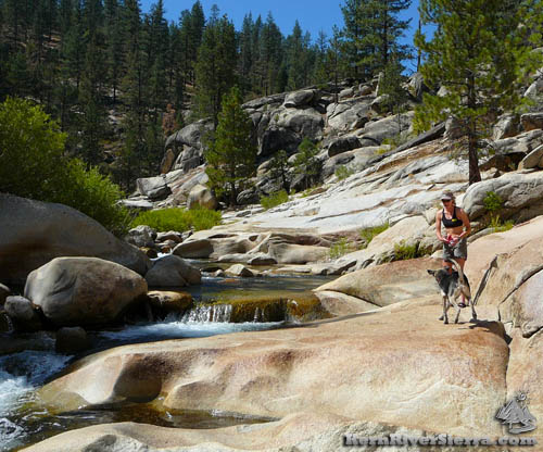 |
Enjoying the Little Kern River.
|
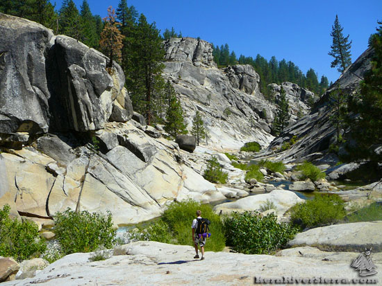
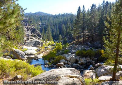
Upriver the scenery is more forested and a little less steep, while the river enters a major cliff-lined canyon further downriver. The area is geologically interesting as well; look around and one will notice evidence of an old basalt flow above the granite bedrock of the river.
Hiking Options
There are so many loop possibilites and great hikes available. One can do a 30 mile loop with Doe Meadow Trail and Kern Flat Trail back to the Forks of the Kern or loop up the Little Kern to Grey Meadow. See the Kern River Sierra Map for more ideas in the southern Golden Trout Wilderness!
Canyoneering/Adventure Hike
Some explorers hike/canyoneer the amazing canyon between the Little Kern Bridge and the Forks of the Kern. Both trailheads are accessed by Lloyd Meadows Rd. While it's an epic adventure, canyoneering the Little Kern should only be attempted at very low Fall flows to avoid dangerous sieves. Some people have scrambled the entire way down, while others describe 6 mandatory rappels. Only do this with proper gear and experience. It takes many people 2 days to complete, and there have been accidents. More information is here.
 |
 |
The Little Kern River in the late summer. |
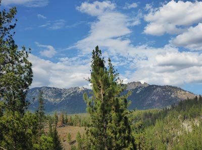
Nice mountain views along the way. |
Fishing Regulations
From the USFS: "Fishing season on these tributaries is open from the last Saturday in April through the 15th of November. Lures, bait, flies etc. may be used. The regular California Fish and Game regulations for the Sierra District apply (5 trout limit and 10 trout in possession)."
Other Concerns
As always, watch for snakes and avoid the river and creeks at high flows.
 |
 |
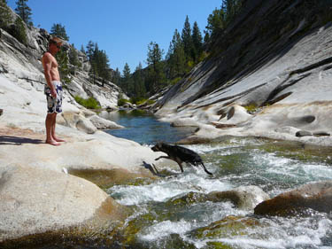
| Fun in the sun. |
Fish Creek Trail. |
Trailhead & Directions
Jerkey Meadows Trailhead:
From the Kern River Valley, drive up M99/Sierra Way north along the Kern River about 20 miles. At the Johnsondale Bridge, cross the river and keep going up to Johnsondale/R-Ranch. Just past the ranch turnoff, turn right onto Lloyd Meadow Road, 22S82. Take this about 21 miles to the end at the Jerkey Meadows Trailhead.
From Parker Pass or Western Divide Hwy, take M50/Parker Pass Dr east to Lloyd Meadow Road, 22S82, just before Johnsondale. Take this about 21 miles to the end at the Jerkey Meadows Trailhead.
Lewis Camp Trailhead:
From Hwy 190/Western Divide Road, turn onto North Road (21S50) near Quaking Aspen Campground (north of Ponderosa or east of Camp Nelson). Continue on 21S50 to a major split at about 4 miles, and go right on the dirt road 20S79. Take this 3.2 miles past the Golden Trout Pack Station to the end of the road at Lewis Camp Trailhead.
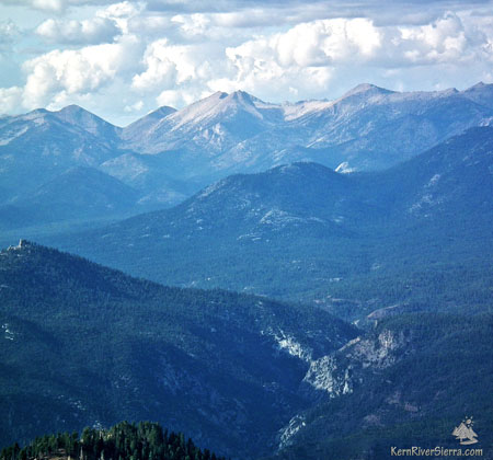 |
View of the Little Kern River Canyon with the Western Divide Mountains of Sequoia National Park in the background. View from the Schaeffer Mountain Hike. |
Nearby Trails & Activities
|
