Hike to some mosaic-colored mellow waterslides near the confluence of Alder Creek and Dry Meadow Creek. Bring your bathing suit!
 |
THE STATS
- Elevation Range: 4800-5000 ft
- Difficulty: 200 vertical ft
- Tread: Non-motorized forest road
- Land: Sequoia National Monument
- Where: Lloyd Mdw Rd, 22S82
- Closest Towns: Johnsondale, Kernville, Ponderosa
- Season: Year-round hiking
- Highlights: Swimming, hanging out, fishing
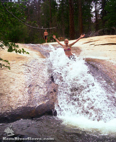
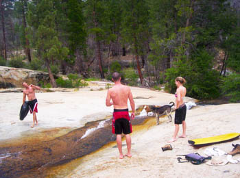
Photo: An entertaining waterslide leads into a small pool on Alder Creek. |
Update after the 2021 Windy Fire
The Alder Creek and Upper Dry Meadow Creek areas are closed for 2021, as the USFS works in the area after the fire. :(
 |
| Silly summer fun. The mosaic-pattern of the wet granite bedrock adds to the beauty of this place. |
Hiking to Alder Creek
For a fun easy family-style summer activity in the Sequoia National Monument, hike up to the Alder Creek Slabs!
The water is always cool and refreshing.
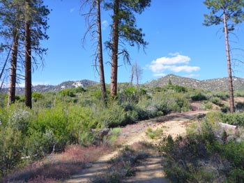
The hike follows the closed forest road, 22S83, which is open to all non-motorized use.
After ascending on the road about .7 miles, look for the short use-trail that drops down to Alder Creek just before its confluence with Dry Meadow Creek. There are a couple water slides on both creeks.
The main slide is featured on the Kern River Sierra Map.
For those that prefer to cool off without getting wet, the sun-soaked granite slabs are lined with shady Pine and Alders.
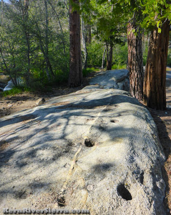 |
| The Native Americans enjoyed this location too! |
HINTS
Bring thick shorts!
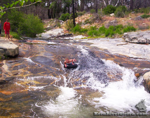
Inner tubes are really fun at the right flows. Boogie boards, not so much.
NOTE
- Access to this entire area has been quite restricted over the years because of irresponsible people's abusive behavior. Respect any others and please pack out your trash!
- The trailhead is actually behind the winter closure gate on Lloyd Meadow Road. The road and creeks can still be accessed by hiking a little more than 1/2 mile each way.
- Avoid the creek at high Spring flows.
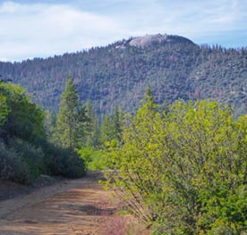
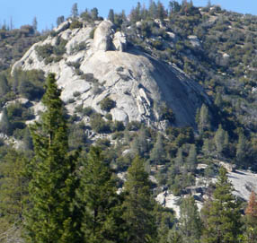
- Rock Climbers will see the large granite dome above to the north; this is K&L Wonderbluff, which is on the same ridge as Dome Rock. (See photo below).
Directions
From the Kern River Valley, drive up M99/Sierra Way north along the Kern River. Cross the Kern River and continue up past Johnsondale.
From Parker Pass Drive/M50, drive towards Johnsondale.
Just northwest of Johnsondale, turn north on Lloyd Meadows Rd (22S82) and drive 5.6 miles to a large day-use parking area on the right. This is about a 1/2 mile past the winter gate.
 |
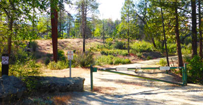
The "Trailhead." |
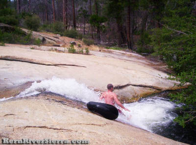
| Wiping out. |
|
 |
 |
| The road with part of Dome Rock peaking out behind. While the hike only ascends .7 miles up this road, it continues all the way up to the Western Divide Hwy. |
Nearby Trails & Hikes
 |
 |
| Hanging out with all the water toys. |
Far above the creek, this granite dome is known as the Wonderbluff. |
|
