Hike to an exciting 150+ foot waterfall in Sequoia National Monument.
Peppermint Creek Falls. |
THE STATS
- Miles: .5 - 1+
- When: Late Spring/Summer/Fall
- Difficulty: 300 feet elevation gain/loss to the bottom of the waterfall.
- Elevation: 5,300-5000 feet
- Tread: Up & back paths & off trail scrambling.
- Land: Sequoia National Monument
- Access: Off Lloyd Meadow Rd, M99, M50
- Where: Near Johnsondale
- Map: Kern River Sierra Outdoor Rec Map
|
Hiking to Peppermint Creek Falls
 |
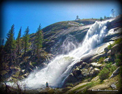
| Hike to the bottom to enjoy this view. |
Enjoy one of the most memorable waterfalls in the region on this hike.
This serene trek leads into a sparsely forested meadow and then through the shade of Jeffrey Pines, before reaching the edge of a 150 foot+ waterfall! (Some guidebooks describe this as a 200 foot cascading falls.)
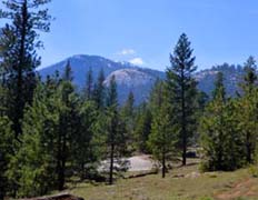
The scenery is excellent. A large dome hovers above Peppermint Creek, as the raging whitewater streaks down an amphitheatre of granite. Out in the distance, the Sherman Massif, Schaeffer Mountain, and Durrwood Falls complete the backdrop.
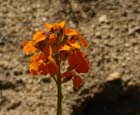 |
| Spring color. |
Its only a short hike to the top of the falls, but many hikers will want to make the steep scramble to the bottom on some use-trails and rocky terrain.
Several great vantage points are revealed as you work your way down the rugged paths on the steep north side of the creek.
Good footwear is nice to have!
The Trailhead
 |
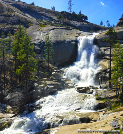
| The scene from the granite slabs. |
The hike commences from a pullout on Lloyd Meadow Road, beyond the Peppermint Creek Campground. Look for the dirt parking area about 1/4 mile after the road crosses Peppermint Creek. This is the last good spot to park before reaching a private property gate.
There is no official trail sign (or trail for that matter) on the road.
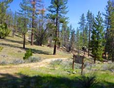
There are a few old trails and double tracks that make up the route; all on the north side of the creek. They merge in a meadow, where there is an old sign.
Follow the old road (now trail) to the boulder-laden knoll above the falls. From here, scrambling around yields some fantastic views! The steep descent ends at an incredible viewing area below the falls.
NOTE: Please respect the private property which is further down the creek.
 |
 |
 |
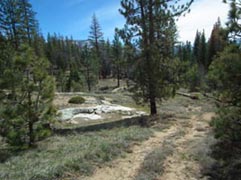
| Near the trailhead; on the old trail/road leading to the falls. |
Dome Rock in view. |
The various paths and roads lead to this old sign. |
Nearby Trails & Hikes
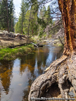 |
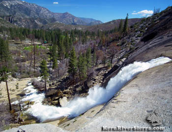
| The tranquil creek above the falls. |
Directions
From the Kern River Valley, drive up M99/Sierra Way north along the Kern River. Veering left, cross the Kern River and continue up past Johnsondale on the M99/M50.
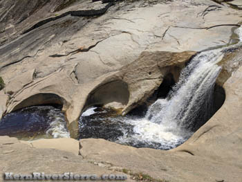 |
| Teacups above the falls. |
Turn right on Lloyd Meadow Road, 22S82. Drive this about 11 miles and pass Lower Peppermint Creek Campground.
The hike commences from a pullout on Lloyd Meadow Road, beyond the Peppermint Creek Campground. Look for the dirt parking area about 1/4 mile after the road crosses Peppermint Creek. This is last good spot to park before reaching a private property gate.
From the Camp Nelson take hwy 190, which will turn into 107. Near Parker Pass turn left on M50. Just before reaching Johnsondale, go left on Lloyd Meadow Road, 22S82, and follow the directions above.
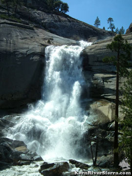 |
A gorgeous waterfall |
|
