A trail that parallels a gorgeous steep granite creek to waterfalls.
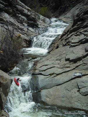
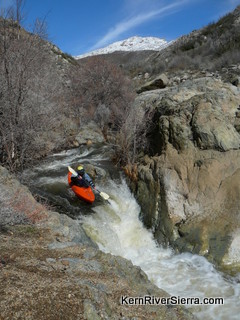
Expert Kayakers paddle the creek when the flows are up, usually during the winter and spring.
This series of waterfalls is known as the "Triple Drops." |
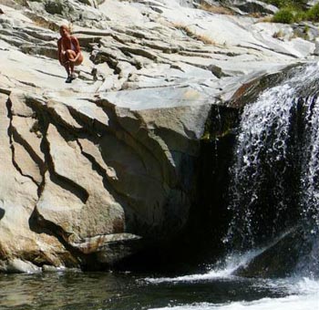 |
| Enjoying a Brush Creek pool in late summer. |
THE STATS
- Miles: 1.5 miles total
- Effort: 250 feet of climbing
- Tread: Up & back rough trail
- Land: Sequoia National Forest
- Where: North of Kernville, M99
- Map: Kern River Sierra Outdoor Rec Map
|
Hiking Brush Creek
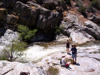 |
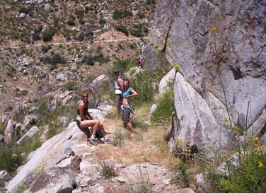
| Hanging out on the creekside granite slabs. |
The Brush Creek Trail is a rough unofficial trail that requires a lot of scrambling and maneuvering around big rock walls and poison oak. It follows brush creek up to the granite wonderland known as 'The Triple Drops.' A much older trail (from the 1800's) continues on the hillside far above the north side of the creek, but it is very overgrown.
In summer, it can be a great place to do a short hike, cool off in a pool, or fly fish.
If you hike in the winter or spring, you may come across groups of kayakers paddling the waterfalls and on down 'the brushy section' to the Kern River. Expert paddlers from across the world come to paddle Brush Creek and the Kern River. To see the creek paddled, hike up during the Kern River Festival.
 |
The trail passes right next to creek in many places:
keep your eyes open for the wildlife. |
Things to know!
Please, never leave rope or place logs across or in the creek. These can be extremely dangerous for kayakers when the creek water flows are up.
Brush Creek is a Class 5 rated experts-only run. The water is swift and cold. The creek is only 'safe' for swimming when the flows are minimal, usually in the late summer.
Other Nearby Trails
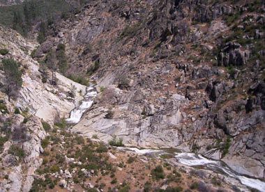 |
View of Brush Creek from Sherman Pass Road. |
Trailhead
From the Kern River Valley, drive up M99/Sierra Way north along the Kern River. Pass Limestone campground and park in the huge turnout(with restrooms) on the left (west). The trail is on the other side of the road.
From Johnsondale, drive east on M99 and cross the Johnsondale Bridge. Watch for the large dirt parking around on the west side of the road before Limestone Campground.
 |
 |
On the old original brushy Brush Creek Trail,
skirting a cliff far above the waterfalls. |
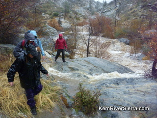
The trail during a huge winter storm/flood. |
|
