A good heart-pounding ride on singletrack close to Kernville.
Fast singletrack below 'Windy Gate'.
|

THE STATS
- 1-20+ Miles
- Mostly Singletrack
- Elevation Gain/Loss: 600-5,000+ ft
- Motorized Multi-Use Trail
- Ride: Out 'n' Back
- When: Winter, Spring, Fall
- Access: Kernville
- Land: Sequoia National Forest
- Map: Kern River Sierra Outdoor Recreation Map, 6th
Update: April, 2021: The lower trail has had extensive trail maintainence to the Harley/Powers Peak Saddle and beyond! Brushing and dirt work! |
On the Trail
 |
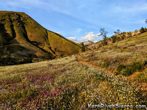
| On the way up the trail; Spring 2020. |
Just a couple miles north of Kernville, the Cannell Trailhead provides access to the entire Kern Plateau trail network. But you're going to have to work hard for it! (Unless pedalling up 7,000 feet is easy for you.)
While some pro XC racers have been known to ride all the way up to Cannell Meadow, most people just bike to one of the viewpoints along the way.
Riding up and back provides a great workout of one of the most popular shuttle trails around. If the name Cannell is not familiar, click here to see what all the hype is about.
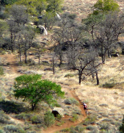
Riding up
The trail has plenty of tough relentless climbing, often spiced up with some difficult technical sections.
 |
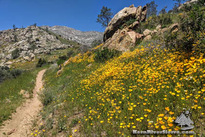
| Pedalling toward Harley Rock & Powers Peak. |
The lower Cannell Trail is actually 99% pedal-able, but don't expect to do it without stopping numerous time to catch your breath or hike a short rocky section here and there.
There is no warm up at first, but the trail provides a few good breaks as it climbs.
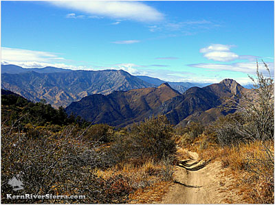
The shortest worthwhile ride would be up to 'Windy Gate.' Its hardly more than a 3 mile ride, but demands a solid 800 foot climb. Just before the final slope below the Windy Gate, there is a trail split. Taking an old road (now a trail) to the right is the easier climb, while the lefthand split is more fun for descending.
Beyond this there are some short technical challenges as the trail enters a series of tough switchbacks. There are a couple more worthy turn-around spots with views of the Cannell Creek Canyon and mountains beyond.
Another worthy goal is to climb to the Harley Mountain saddle, where a steep hiking trail ascends the spectacular peak/viewpoint where gold was discovered in the 1800s! To get to this saddle, you'll have to climb a relentless 4.5 miles with 2,400 vertical feet of climbing. Sidenote: An 'Old Mule Trail’ descends the west face of the mountain, but it's quite overgrown.
 |
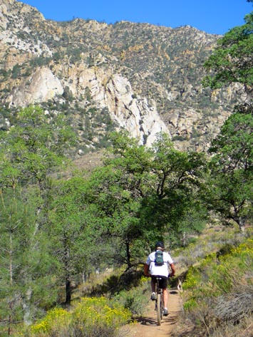
| A flowy section of trail just above the Harley Saddle. |
Its not too much farther up to the top of the "Plunge Hike-A-Bike," where Potatoe Patch trail historically veered off. A 3,000 foot climb to this spot reveals views of the crags of Pine Flat, Lake Isabella, and great northern views of the mountains.
Great cross country riders who have mastered the art of pain will sometimes climb all the way to Pine Flat (the top of The Plunge with more than 5,000 feet of climbing), which in most years will be melted out by April with its primarily south facing exposure. Of course, one can continue to Cannell Meadow or even veer off to Little Cannell Meadow for an adventure (This is getting into the territory of Bike Packing though!)
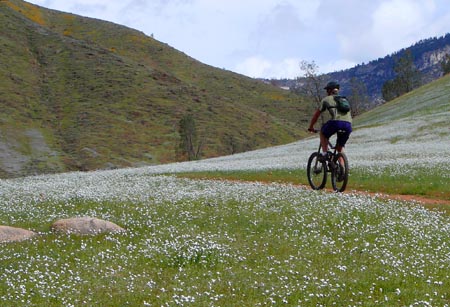
On the way back down, watch for hikers on the way down, especially during wildflower season!
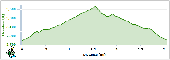
Elevation Profile for the short ride to Windy Gate
Trailhead
Drive north of Kernville on Mtn 99 / Sierra Way for 2 miles, and look for the trailhead on the right.
 |
| When there are spring flowers, the upper trail still has snow. |
Nearby Activities
|