The USFS recently brushed parts of the upper trail recently!
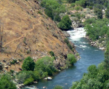
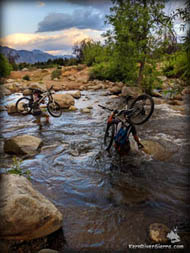
The trails are riding really well!! Locals of all ages and abilities have been looping the first 4 miles of Whiskey Flat Trail with the ultra popular use-trails. Conditions have been great on the Kernville side of the trail. A community rock bridge spans Bull Run Creek for an easy crossing.
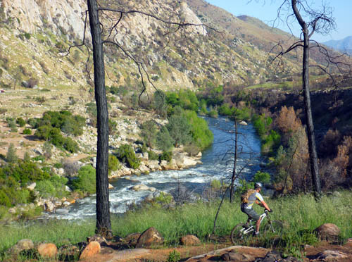
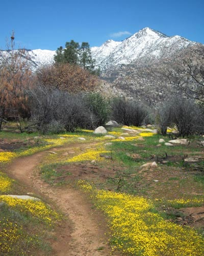
Photo: Spring 2017
On the Trail
The historic Whiskey Flat Trail roughly parrallels the Kern River and connects Fairview/McNalley's to Kernville by way of a long, arduous, and rugged 15 mile singletrack trail. Don't be mislead by the "Flat" in the trail's name; the trail frollics up and down through countless gullies, creeks, and mountainous terrain on its way to Kernville. Completing the 1-way shuttle ride is a feat to be proud of.
For this reason, most of the mountain bike action occurs in the lower 5 or 6 miles of the trail starting in Kernville.
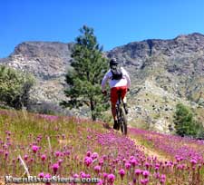
In the spring wild flowers line the singletrack as the last patches of snow on the 8,000 foot Baker Point melt away.
In this local training ground, out 'n' back rides and loops with various use-trails add variety to the back yard ride.
The most popular bike loops are north of Bull Run Creek.
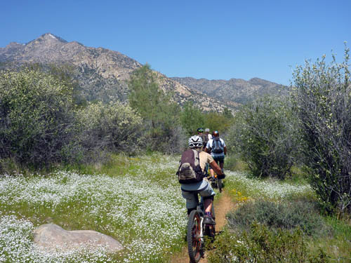
While Whiskey Flat is ridden all year long, the trail conditions vary dramatically throughout the year. Even the entire look of the ride changes with the seasons.
Winter and Spring can bring incredible wet and packed trail conditions, with flowing creeks and snowy peaks.
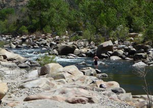
Summer brings sandier and warmer conditions. But while the wildflowers fade away, the swimming holes that develop in the Kern River are a welcome oasis for trail users.
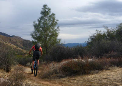
Taking advantage of the fast trail conditions after a winter rain storm.
Keep in mind, however, that much of the riding is away from the river, although there are several access points and views throughout the length of the trail.
Even though the ride is very difficult and demanding, it is popular among all levels of riders.
Sweet sections of smoother flowing trail are scattered throughout the ride. There are also numerous rocky technical challenges, requiring negotiation through rocks while climbing or descending. Super fun stuff!
In the lower half of the trail, there are many steep and demanding climbs, but none of of them are very long. Expect a few hike-a-bikes, although most of the toughest sections are make-able with the right bike and legs of steel... and a killer attitude... and maybe some bass-thumping pump tunes blasting in the earphones... and recent rain always helps.
Ride Destinations
Easy loops of a few miles are possible with the use trails in the Bull Run Creek area.
Two local-user-created trails known as Bootlegger and Moonshine Trails, are to the north of Bull Run Creek. These trails are extremely popular with locals and make a 10+ mile double loop with Whiskey Flat Trail. Bikers will ride these trails every day of the year.
On Whiskey Flat Trail: A good 6+ mile ride is an out 'n' back to the 'Cable Wave'. About 3 miles down the trail, there is a sudden right-hand turn off the main trail. It's at the bottom of a fairly steep (but short) downhill that ends with huge boulders in the trail. Take this to ride out to a little beach below the "Cable Wave."
Cooling off at the Hospital Flat area.
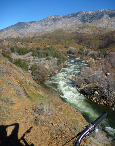
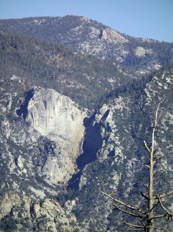
Cable Rapid Bluff: Less than a 1/2 mile past the 3-Mile turnoff, there is another spot to check out. The trail cruises along a bluff above the scenic Cable Rapid with views of the Kernville Dome. Great place to simultaneously check out rock climbers and kayakers during the Spring flows.
On the trail above Class 5 Sock 'Em' Dog Rapid.
Flume Rapid Bluff is another good option for a 8+ mile pedal. From the bluff above Cable rapid, the trail steeply descends into Dark Canyon and becomes a very technical boulder-strewn ride up to the small creek. A quick hike-a-bike section follows, but then the trail improves and passes through Stormy Canyon before climbing to a bluff that overlooks the exciting Flume Rapid.
A great 10 mile ride takes you to a section of trail above and across from lower Hospital Flat Campground. One will have to hike off trail down the river. The River bends here opening a new set of mountain views. There used to be a small cairn marking a faint trail that descends right and down to the beach area.
Expect at least one more short hike-a-bike to get here. The swimming hole makes it all worth it!
Sock 'em' Dog, a big powerful Class 5 rapid during the spring run off, is about 6 miles up the trail, which contours an exposed cliff here.
Just upriver of the rapid, a sandy meadow provides river access and a welcome resting spot. The late fall colors in this corridor are usually amazing! Biking to this destination is a rewarding goal, and makes for a demanding 13 mile ride.
Pedal another .5 miles up the trail, and you come to the Thunder Cliff, a super gnarly, steep and exposed, burly section of trail. The trail itself is a marvel to behold, with views to match. (See footage here or below). Since the trail steeply ascends the cliff, a hike-a-bike here is inevitable and continuing to walk parts of this section is strongly encouraged. One mistake here will be your last. This cliff is about 6 3/4 miles up from the trailhead, and near the start of the Class 5 whitewater classic, The Thunder Run.
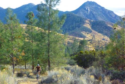
Pedaling through the beautiful Springhill Flat area.
Continuing up river, the trail exits the Bull Fire boundary and gets faster and flowier for a few miles, as it cruises through Springhill Flat. Some of the best stretches of singletrack on the trail have recently been cleared and maintained in this area.
A few short-ish hill climbs beyond the Springhill area is Ant Canyon (Creek), a very worthy goal for extremely fit, skilled, and prepared bikers. With MEGA effort from pedaling through every type of trail condition, biking up to Ant Canyon and back makes for a 20-mile long mountain bike ride.
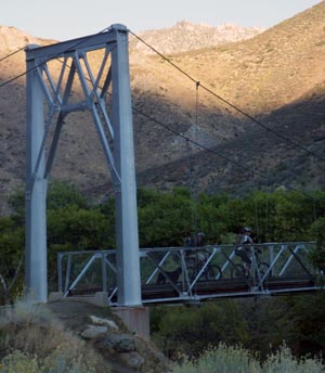
The full shuttle ride, with 15 demanding miles, starts at the Fairview Bridge and includes a difficult climb (expect some hike-a-biking) up some ridges at the foot of Baker Mountain.
A view of Whiskey Flat Trail above Sock 'em Dog, as seen from the Old Flume/Edison Trail.
This wild and remote section of trail requires a lot of exertion, but has some outstanding sections of singletrack and a variety of scenery. Since the recent trail work, many bikers have been rediscovering a whole new ride right in Kernville.
Other nearby ride possibilities:
The Tobias Trail also starts near the Fairview Bridge off of Whiskey Flat Trail.
Or attempt the Kernville Mega Loop: Combine Whiskey Flat Trail with the Old Flume Trail, just plan on unimaginable and indescribable pain.
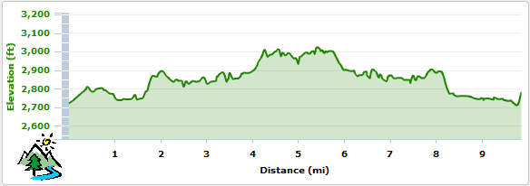
Elevation Profile for Ride to 5 Mile Beach and back
The toughest sections of Trail on upper Whiskey Flat include views of Salmon Creek Falls.
The upper Whiskey Flat Trailhead is near the Fairview Bridge next to McNally's.
Trailhead
The lower Whiskey Flat Trailhead is located 2 miles north of Kernville at the end of Burlando Road. The upper is accessed from Mtn 99 just north of McNally's Restaurant.
Dont Get Lost!
This trail and some optional routes are depicted on the local adventure map!: