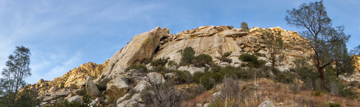
Climbing Book RockConsidered a classic by the longtime local climbers, many of these routes were put up by Herb & Eve Laegar as well as Kodas, Newman, Vernon, and a few others.
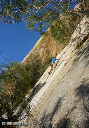
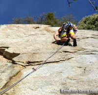
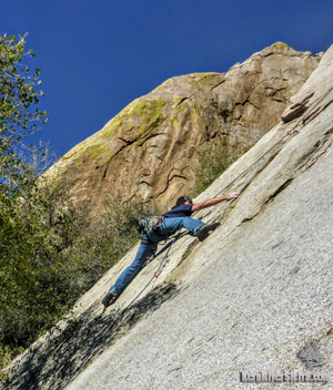
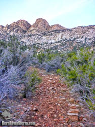
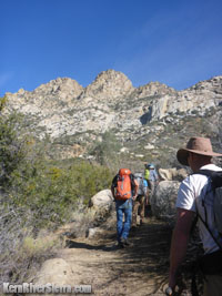
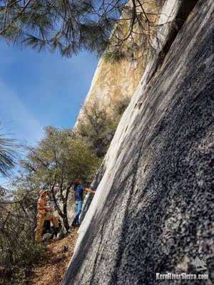
While there are some favorites like Jigsaw 5.8 and Title Page 5.7, the majority of these quality routes are rated 5.10 to 5.11 and are 2 pitches in length. It is thought that Dyslexia, a 5.12+ route on the main buttress arete has not been repeated, since Vaino Kodas climbed it years ago. 15 of the routes are described in the older guidebook: Southern Sierra Rock Climbing: The Needles There is potential for new routes in the area. Where is it?Book rock is about 12 miles north of Kernville with 1 mile on dirt roads. Climbers will pass the Kern Slabs/Kernville Rock, New Directions Cliffs, Chico Rocks, Roadkill Rocks, and the Salmon Creek area climbs on the drive up. Approach Trail and ClimbsThe approach trail was just trimmed up and is much easier to follow (December 2017). More than half the trail is gradual, while the final jaunt up the hillside steepens. Cairns and fresh clippings mark the way to the main wall on the right side of the Book, where the bolted route "Lexicon" 5.10c/d ascends to the anchor near bushes off to the right. Also to the right (but currently dirty) is a nice 5.9 crack, Short Story. These provide access to Jigsaw and a few 5.10 routes above. A series of 5.11 climbs, some with very old bolts, are off to the right of Lexicon. To hike over to the Main Buttress and left side of the formations to the right will still require a bit of bushwacking at the present time. Classics such as Welcome to Book Rock, 5.11, reside here. Heading up the slope to the south of the main wall, there other older established routes on the Paperback Slab, Hardbound Boulder and the Sequel Wall, ranging from 5.9 to 5.12.
Nearby Climbing
Directions
From Sierra Gateway Market in Kernville, drive north on Mtn 99 for 11.5 miles. After passing the road that accesses Rincon Trail and crossing the unobvious Salmon Creek bridge, turn right on the next dirt road. This is just before the Salmon Creek Falls Viewpoint sign at the dirt pullout (one of the take-outs for the Chamise Gorge whitewater run). Once on this road, look up to the right to catch a glimpse of Upper Salmon Creek Falls. Stay on the main road; you will pass a minor dirt road veering left. Just ahead at a more obvious intersection, turn left on the contouring dirt road. (going right ends at Salmon Creek). Ignore the road that climbs up to the right and keep contouring on the main dirt road. After curving around a minor gully and then 2 larger drainages, look for a cairn (stacked rocks) that marks the approach trail. This is approximately 1 mile from the pavement.
|
||||||||||||||||||||||