Hike to the top of a dome-like granite monument above Dry Meadow Creek.
The hike follows the ridge up to the top of Elephant Knob. |
THE STATS
- Difficulty: 700 vertical ft
- Tread: Up & back use-trail and class 2 scrambing.
- Land: Sequoia National Monument
- Where: Lloyd Mdw Rd, 22S82
- Season: Year-round
|
 |
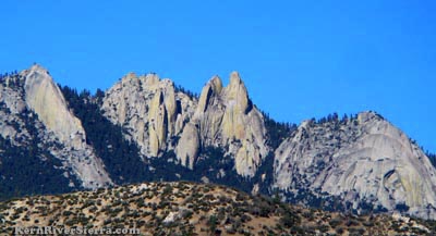
| A look at the general area from Capital Rock above Johnsondale. |
Hiking to the top Elephant Knob
 |
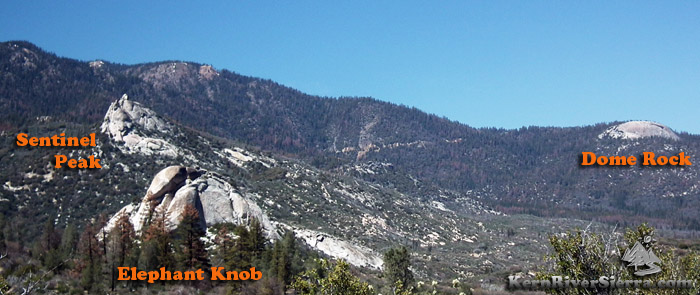
| On the way up to the top of Elephant Knob. Sentinel Peak and part of Slate Mountain are in the background. |
At the lowest elevation of many striking granite landmarks in the area, Elephant Knob is also one of the quickest to hike to. (Dome Rock is the easiest and shortest!)
Like Sentinel Peak, it is located before the winter closure gate so one can do both hikes all year long.
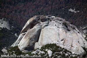 |
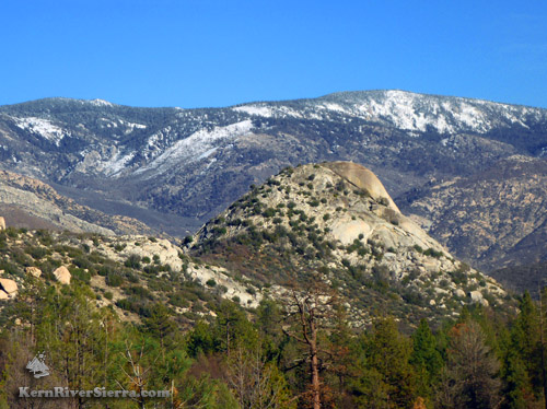
| The Elephant! |
Once on top, enjoy views of the cascading pools of Nobe Young Creek, the Dry Meadow Creek Valley, and a panorama of mountain views including Sherman Peak, Schaeffer Mountain, The Needles, Dome Rock, and Slate Mountain.
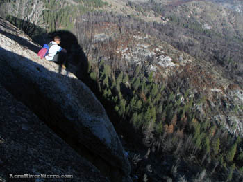 |
| A little too close to the edge. |
The backside is a massive cliff, which is lined with rock climbing routes.
On the Hike
Commencing just off Lloyd Meadows Rd (22S82) at a small turn out on the right side of dirt road 22S53, look for a brushy use trail ascending a small hill.
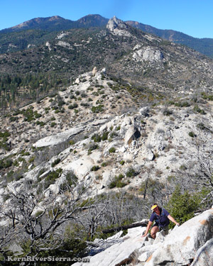
The route follows an unofficial use-trail that was both a fire-break and a motorcycle trail at one point. As it approaches Elephant Knob, the route becomes more of a scramble with some class 2 hiking.
After a short climb, the route travels just north of the higher knob and then roughly continues on the ridgeline to the top.
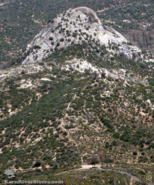 |
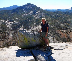
Photo Above: On the top!
Photo left:
One can see the faint use-trail heading toward Elephant Knob from the small pullout just off the road; as seen from Sentinel Peak. |
Nearby Trails & Hikes
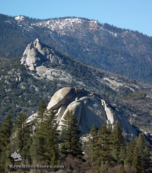 |
| Elephant Knob with Sentinel behind. |
Directions
From the Kern River Valley, drive up M99/Sierra Way north along the Kern River. Cross the Kern River and continue up past Johnsondale.
From Parker Pass Drive/M50, drive towards Johnsondale.
Just northwest of Johnsondale, turn north on Lloyd Meadows Rd (22S82) and drive 3.8 miles to road 22S53. This is located on a ridge that comes down from Sentinel Peak. There is a small turnout on the right side of 22S53, and the use trail ascends through some brush on the backside of the open area.
|