Immerse yourself into natures beauty on this short hike.
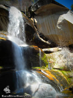
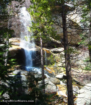
Nobe Young Falls. |
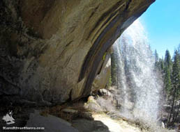 |
| In the alcove behind the falls. |
THE STATS
- Distance: Less than 1 mile total.
- Difficulty: 150 feet of climbing.
- Hike: Up & back use-trail & off trail scrambling.
- Where: Sequoia National Monument
- Access: Western Divide Hwy, near Ponderosa
- Map: Kern River Sierra Outdoor Rec Map
|
Hiking to Nobe Young Falls
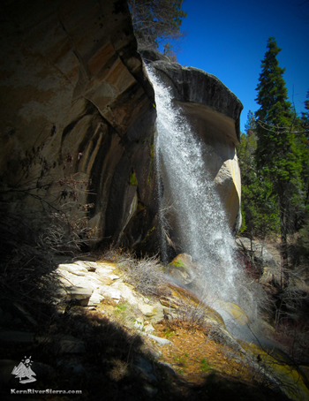 |
| The upper falls and alcove. |
Hidden in a steep forested canyon, most people pass right by this natural beauty on their way to Trail of 100 Giants or any of the other wonders of the Western Divide Hwy.
While there is no official trail, the route utilizes old logging roads and fairly maintained use-trails. The lack of signs give this hike much more of a serendipitous and adventuresome feeling, despite the proximity to the road.
After a short hike down into the shady drainage of Nobe Young Creek, one suddenly stumbles upon a shining ribbon of light through the trees.
Nobe Young Falls is 80 feet tall according to WorldWaterfallDatabase.com.
Once there, hikers will enjoy scouting the large cave behind the waterfall, where wispy threads of water blow in the wind.
Dont miss the other various vantage points further down the creek.
In the fall, look for nearby raspberries and elderberries!
The Trailhead
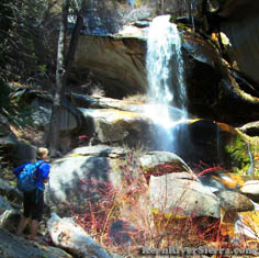 |
| Hiking down below the falls. |
Nobe Young Creek is located between Trail of 100 Giants and Dome Rock on the Western Divide Hwy, M107.
The hike is unsigned and not very obvious. Look for a dirt pullout to the south of Nobe Young Creek with some remnants of old logging roads.
This is about 6.8 miles south of Ponderosa Lodge, and 6.7 miles north of the M50 if coming from Parker Pass or Johnsondale.
Start hiking down the barricaded logging road to the north past the large tree. In 500 feet or so, veer right onto another defunct logging road/trail.
In about 1/3 mile from the beginning, a use-trail abruptly cuts off left and descends to the creek. As trails splinter off, pick the route that suites you; staying left leads to the alcove behind the waterfall, others lead to other points along the creek.
 |
 |
 |
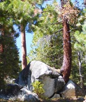
| Sights from the trail. |
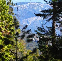
Views across the Kern. |
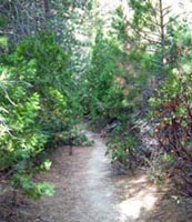
Upper section of trail. |
|
A gorgeous waterfall |
Nearby Trails & Hikes
Directions
From the Kern River Valley, drive up M99/Sierra Way north along the Kern River. Cross the Kern River and continue up past Johnsondale on the M99/M50. Turn right on M107, Western Divide Hwy and drive 6.7 miles to the dirt pullout on the right (1 mile past Last Chance Rd, 22S02).
If coming from Camp Nelson area, the pullout is about 6.8 miles past the Ponderosa Lodge on the left.
 |
Another vantage point. |
|
