Hike the Bull Run corridor from Whiskey Flat Trail in Kernville.
|
THE STATS
- Miles: 1-5+ miles
- Elevation Gain/Loss: 50-800 ft
- Hike: Up & back
- Tread: Old county road easement
- Elevation: 2700+ ft
- Land: Sequoia National Forest & Private Land
- Access: Burlando Rd at Whiskey Flat Trail
- Town: Kernville
- Season: Year-round
- Map: Kern River Sierra Outdoor Rec Map
- NOTE: Much of this area is private land. The main route (old road) up to the pools/smelter apparently is a public county easement. Show respect and do not trespass. There are waterfalls and pools to explore that are located on USFS land beyond the smelter area. See the map for the property boundaries.
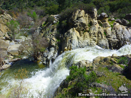
Photo: Bull Run Creek. |
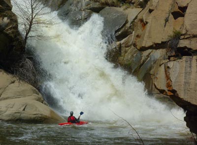 |
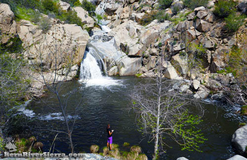
| Lookout for high water in some years! This pool and series of waterfalls is below the old trail, roughly 3 miles up depending on the route taken. It is beyond the smelter area on USFS land. |
Bull Run Creek Hike
From its headwaters near Black Mountain and Sunday Peak, Bull Run Creek flows down through the Sequoia National Forest into the Kern River, just above Kernville.
This is part of the local's backyard playground; every day the Whiskey Flat Trailhead provides all sorts of entertainment for outdoor enthusiasts.
On the Trail
The Bull Run Creek area has a deep history of mining. The routes left behind are now often used by hikers, joggers, bikers and dog walkers. However, much of this area is on private land; please respect the rights of the land owners by staying on the public easement.
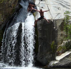 |
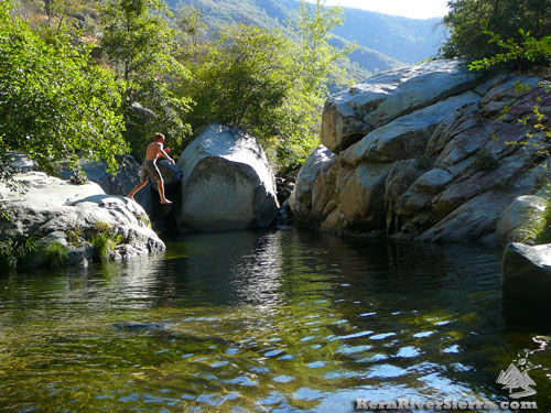
| Summer fun. |
The Whiskey Flat Trail passes through private land and crosses Bull Run Creek about a mile from the trailhead.
Also near the trailhead, the old county road splits off to the left and ascends to the remains of an old Smelter (where the ore was processed).
The remains of rock shelters, from a dense population of miners and workers, are scattered all over the area.
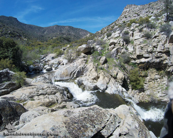
One can continue exploring up the creek and find amazing pools and several waterfalls once on USFS land. One hidden waterfall is over 20 feet tall!
The route continues as an old brushy trail that ascends up and over the hill above the smelter and then follows the creek for another mile or so. It ends near a double waterfall and a huge swimming hole (on USFS land).
Trailhead & Directions
Bull Run Creek is accessed from the lower Whiskey Flat Trailhead. It is located 2 miles north of Kernville at the end of Burlando Road.
Nearby Trails & Activities
 |
|
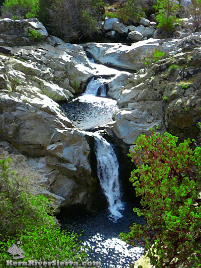
| Bull Run Creek: 20 foot waterfall at high flows. |
Current Webcam Views
Baker Point Webcam looking south and east to Kernville and surrounding areas.
|