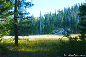
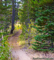
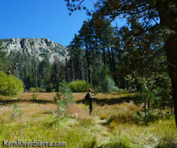
On the TrailThe trails utilized on this hike are multi-use motorized singletracks that may see some motorcycle traffic on summer and fall weekends. The hike commences at the Corral Trailhead for Trout Creek Trail, 33E28, off Corral Meadow Road (See Directions below). Go north (left) on the trail. The initial descent is often dusty, but the tread usually improves as it passes several springs. The forested singletrack will open into a quaking aspen-lined meadow as it approaches Corral Meadow.
In about 1.2 miles veer left on the signed Schaeffer Trail, (turning right leads to West Meadow and the High Meadows Loop, a nice bike ride). From this junction, the trail follows the Corral Meadow fork of Durrwood Creek down to its confluence in another 1.2 miles. After passing several springs and a meadow with with older burnt trees, the trail comes to an intersection with North Meadow Pass Trail at almost 2.5 miles into the hike. Go right and continue along Durrwood Creek.
Scotch Whiskey Camp turnoffRoughly 1.3 miles from the North Meadow Pass intersection (about 3.8 miles into the hike), the trail starts to cruise into a darker denser forest and makes a short steep dip down to a small brook that is perpendicular to the trail. At the confluence of this brook and Durrwood Creek (to your left), sits the location of the old Scotch Whiskey Camp. The easiest way to see the camp is to stay on the trail up the hill, and then go left cross-country to the confluence. The camp is on the other side of Durrwood Creek. If the water is high, there are usually logs to cross the creek nearby.
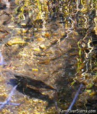
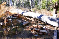
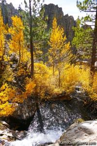
Surrounded by pine trees and lots of red currant, the Scotch Whiskey Camp is an interesting site from the 1930's. A large brick oven still sits in the middle of camp, along with a fire pit, some log chairs, and firewood. The glory of this camp has diminished over the years, with some new backpacker trash, a downed log bisecting camp, and a few missing features, such as the original sign and a large rock table. Perusing upstream on the grassy banks of Durrwood Creek is an enjoyable and serene experience, and one might spot some of the small native trout in the small pools. To the edge of Durrwood CanyonFrom the camp, there used to be an obvious rock-lined trail along the creek heading downstream to the edge of Durrwood Canyon 1/4 mile away. So many logs have fallen that it has disappeared for now.
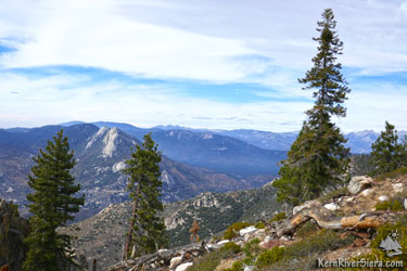
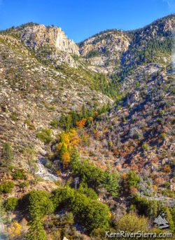
Make your way downstream, jumping over logs and when you start to see cliffs through the grove of aspens, it's time to start heading uphill to a rock outcropping. The terrain immediately opens up with views of the Western Divide over the edge of the Kern Plateau. Slate Mountain, Sentinel Peak, Elephant Rock, and so many iconic Kern River features standout to one's eye.
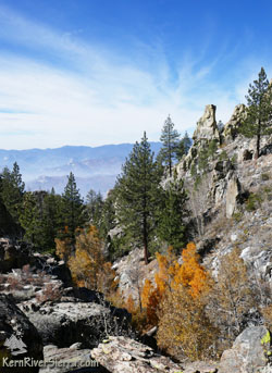
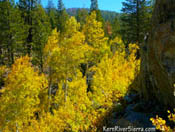
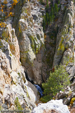
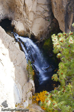
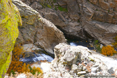
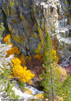
Like the Upper Salmon Creek Falls Hike, it's very hard to see the actual waterfalls from above. (Durrwood Canyon is so steep and remote, it's even difficult to see the falls from below!) Hiking around will yield sights of some small slides and pools as one absorbs the drama of the creek plunging thousands of feet below. Looking across the creek, note the knoll rising above the cliffs. This is "Durrwood Knoll," a highly recommended destination for this trip (see below). Exploring Durrwood Knoll"Durrwood Knoll" is a small peak, situated north of Durrwood Canyon and south of Cedar Canyon. For those willing to scramble and explore off trail, this area has a ton to offer and is a major highlight of the trip.
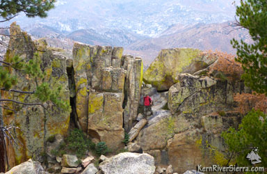
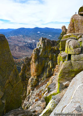
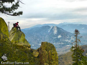
From the Scotch Whiskey Camp, head back to the Schaeffer Trail and continue hiking north about 1/3 mile. At the saddle, veer left for off-trail hiking on the knoll. Hiking to the top of the knoll, and beyond to the west side, reveals an awesome vista of the High Sierra peaks and possibly the best view of The Needles anywhere! To see the vortex of sheer walls converging around the Durrwood waterfalls, traverse above the cliffs on the southern side of the knoll. It seems like every few steps opens up another intriguing perspective of the creek's numerous waterfalls (that continue for 2000 vertical feet). The farther you go, the more you will see. Many of the cliffs are several hundreds of feet high, and house some newly developed rock climbing routes. Canyoneers have also rappelled down to the Rincon Trail. It's easy to forget how far you can actually wonder! When done exploring return to the Schaeffer Trail.
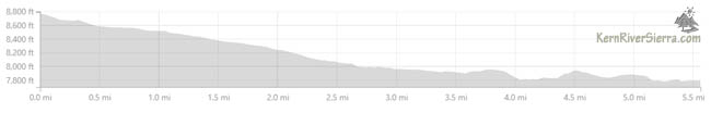
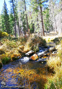
On to Stony Meadow and beyondThe hike doesn't have to end! Or, for those who avoid hiking off trail and may want to skip the Durrwood Knoll, Stony Meadow is a great destination for the hike as well. Hike back to the Schaeffer Trail and continue north. Depending on where you return to the trail, Stony Meadow is approximately 1.7 miles away. The rolling trail will pass by spring-fed Schaeffer Meadow, where an older burn opens the terrain for awhile. After climbing a couple hills and re-entering the forest, the route meets the Cedar Canyon Trail junction. See Lookout & Schaeffer Mountains Loop hike for a description of this area, photos of the signs, and a discussion of hiking options. Veer right for the start of the "Old Sheep Driveway Trail." This leads to Stony Meadow at the base of Schaeffer Mountain's West Face in .2 miles. If Stony Meadow isn't far enough, one can hike up to Schaeffer Ridge on the edge of a recent burn. There are some spectacular viewpoint knolls that make a superb destination, see the Loop Hike for more info. Elevation Profile: Corral Trailhead to Stony Meadow 1-way
Nearby Trails & Hikes
DirectionsFrom the Kern River Valley, drive up M99/Sierra Way north along the Kern River. Turn right on Sherman Pass road and drive up and over Sherman Pass 17.5 miles. About 2 miles past Sherman Pass, turn left on Corral Meadow Road, 22S26. Drive past the corrals to the Firesafe Parking area near the signed Trout Creek Trail, which crosses the road. The hike starts by heading north on the trail.
|
||||||||||||||||||||||||||||||||||||||||||||||||||
.jpg)