The Epitome of Backcountry Riding. Be Ready for it all. Epic.
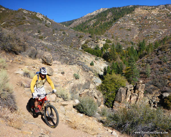
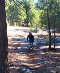
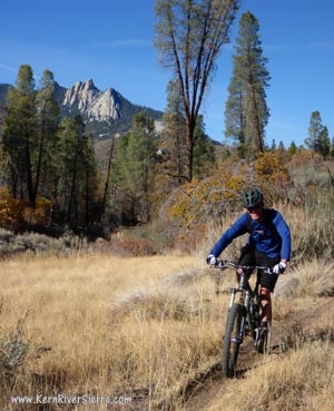
Halfway down the Cedar Canyon Plunge. Rider: "jfsh"
UPDATE! 2021: Still waiting for some trail maintenance. Not recommended until more trailwork is done.
July 2019: This trail got pretty worked from the winter, and is also very bushy in the lower sections. Awaiting trailwork...
May 2018: S.O.S. recently cleared the trails! |

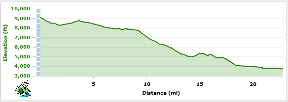
THE STATS:
- Miles: 22.5
- 1900 ft uphill
- 7100 ft drop
- Shuttle Ride
- Motorized Trail
- Top Elevation: 9200 ft
- Low Elevation: 3760 ft
- Best: Summer/Fall
- Sequoia NF
- Start: Sherman Pass. End: Johnsondale Bridge
- Access: Kernville, Johnsondale, Kennedy Meadows
- Map: Kern River Sierra Outdoor Recreation Map, 6th ed
|
The Ride
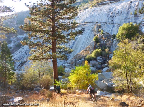
If Cannell Trail is King of all-mountain rides, then Cedar Canyon is the unruly and wild brother; and a possible usurper to the throne.
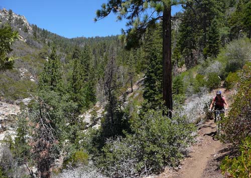 |
On the Cedar Canyon Trail: very, very far from any road.
|
Both preside over Sherman Pass: While Cannell Trail leads south from the pass, this ride circles north and then down Cedar Canyon and on to a rugged section of the Kern River.
Cedar Canyon is more remote, less-ridden, physically and technically more demanding, and brushier (especially if ending the River Trail) than Cannell Trail.
While both rides each contain an awesome downhill "plunge," Cedar requires several miles of significant exertion and committing technical moves after the 4500 foot descent.
If Cannell Trail is easy and you seek more adventure, go bike this truly epic trail. Later as you recall your journey of pedalling along lush high alpine creeks and then surviving harrowing white-knuckle cliff-side descents to the Kern's wild granite-lined banks, your memories may soon fade into great stories of mountain bike legend and lore.
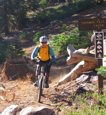 |
| Dropping into Sherman Pass Trail from the top. |
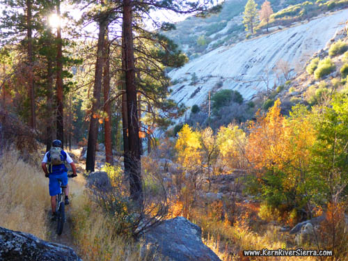
On the Trail
The Cedar Canyon Ride is the sum of several trails: Sherman Pass Trail, Trout Creek Trail, Schaeffer Meadow Trail, Cedar Canyon Trail, Rincon Trail, and the optional River Trail. This is a challenging cross-country ride with a gigantic downhill in the middle.
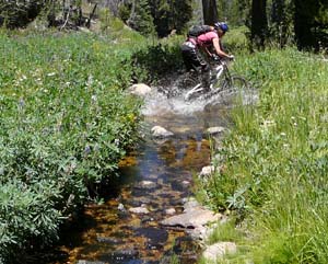 |
Lush trails in the Spring.
|
Ride Details
 |
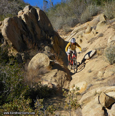
 The top half of the Cedar Canyon Trail completely rips! The top half of the Cedar Canyon Trail completely rips! |
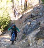
| On the Schaeffer Trail. |
|
Its best get a map for this one, unless you have someone to show you the way. Some of the trail intersections can be easy to miss.
There are a few different ways to ride this partial loop/shuttle ride. The most popular version is to drop off the rocky backside of Sherman Pass on the appropriately named Sherman Pass Trail. The ride starts with a bang, as the trail is instantly steep and filled with boulders. When the trail's downhill pitch ends after about 2 miles, it crosses Trout Creek.
Turn left and start climbing up Trout Creek Trail. After passing the second dirt road (Corral Meadow Road), the trail is mostly downhill to the signed Corral Meadow. At this junction, turn left on Schaeffer Trail. (Turning right leads to the High Meadows Loop, a nice summer cross country ride).
A fun section of trail leads to the next intersection at Durrwood Creek; turn right. The trail follows the creek for awhile, then traverses and climbs a couple hills before reaching the intersection with the Cedar Canyon Trail at almost 9 miles. And old sign on a tree, marks this intersection in the forest. Its a great place to have a snack before charging downhill for several thousand feet!
 |
 |
Flying down toward Durrwood
Creek and the Rincon Trail. |
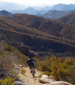
Descending towards The Needles, with the Kaweah and High Sierra Peaks just beyond. |
Turn left and drop down the Cedar Canyon Trail which roughly follows Cedar Creek as it flows into Durrwood Creek near the bottom of the trail. The top of the descent is nonstop alpine action until it crosses Cedar Creek. At this point, there is a tiny climb and the scenery becomes more wide open and sunny. There's more exciting downhill ahead, but dont miss the scenic viewpoint to the left. Sights of the Durrwood Creek chasm and waterfall is just up the hill, while the Needles, Dome Rock, and other granite wonders of the Kern Basin are opposite.
The downhill mellows out and reaches the Rincon Trail intersection; another great place to rest and regroup. At this point, almost everyone is completely stoked on the ride! But don't forget, there is still a ton of challenging biking left.
 |
 |
| Beautiful meadows on the Rincon Trail. |
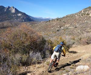
Reward for the tough climbs on Rincon Trail. |
The ride now goes left (south) on the sunny (hot) Rincon Trail and soon crosses Durrwood Creek. The next 3 miles include some steep climbs (some hike-a-bike), with some excellent downhill sections in between. Essentially there are 4 climbs on Rincon Trail; the first is the worst.
Next, the River Trail veers off to the right. There are now two options that require a major decision. Either stay on the Rincon Trail (see description below), or take the longer and more committing route down the River Trail.
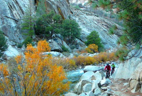
The truly epic way is to turn on the River Trail, which is 5 miles from the Johnsondale Bridge. This trail is difficult to describe. Some people absolutely love it, while others hate it. No matter what, everyone thinks it is spectacularly beautiful!
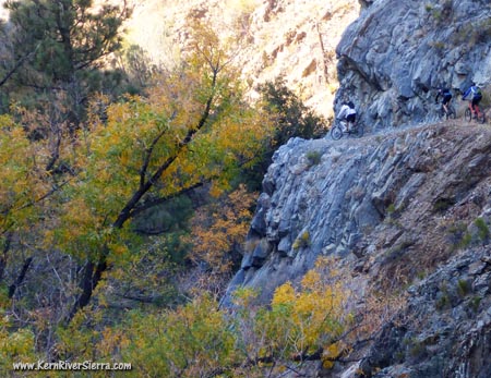 |
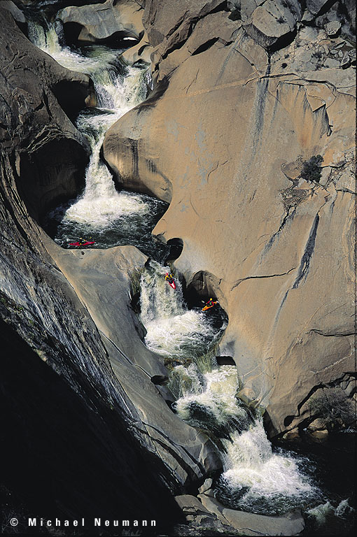
Dropping in on the River Trail. The extreme exposure continues for a mile as the old miner trail traverses the cliffs above an exposed bedrock creek. Use extreme caution here!
This creek recently flooded and actually washed out a section of the trail near the river.
See another cliff photo here. |
The trail is for riders with expert technical skills (almost trials riding skills) who don't mind some hike-a-bike sections (half of the trail for many riders), or risking a fall off a cliff or into a class 5 rapid in the Upper Kern River. While there are amazing sections of "normal" trail conditions, the majority of trail requires exhausting balancing and maneuvering - often with some brush at your handlebars. As you ride downriver, there is still climbing involved - especially after reaching Dry Meadow Creek (the terminus for the 7 Teacups). It doesn't let up until it ends at the Johnsondale Bridge.
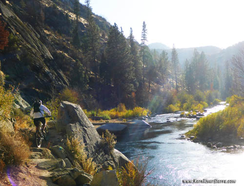 |
| A typical trail scene on the River Trail. |
The other option is to ride out on the rest of the Rincon Trail. This is still physically demanding, but its a little shorter and easier. If you are exausted at the River/Rincon intersection, its best to stay on Rincon even though there is a big climb ahead.
After the intersection with the River Trail, there is one more big climb with some hike-a-biking. Then enjoy a 2 mile descent to Brush Creek. [Note that the trail crosses the Sherman Pass Road on the descent and continues on the other side.] Once, near Brush Creek, take the dirt road back up to the pavement (Sherman Pass Road) and ride back down to Johnsondale Bridge.
 |
| One of the very ridable sections of River Trail near the Class 5 West Wall rapid. |
 |
| Fall is so spectacular on the River Trail. |
The Alternate Sherman Peak Version of the Ride
The Sherman Peak version is described in the Sierra Sojourner blog here. Instead of taking Sherman Pass Trail, you can climb Sherman Peak Trail to the top of the mountain for top notch views of the Sierra. Then descend down the dirt road 33E29 to the excellent North Meadow Trail. This will merge into the Schaeffer Trail and continue the same way.
Expectations
Skills required: steep downhill riding experience, long cross-country ride experience, expert technical skills, more endurance than you think you need. Lots of hike-a-biking. This is much more challenging, mentally demanding, and committing than Cannell Trail. While its possible to finish in 4-5 hours for prepared bikers, some have taken up to 13 hours to complete the ride.
Elevation Profile for Sherman Pass Tr to Cedar Canyon Tr to River Tr
 |
| A couple miles to go to the Johnsondale Bridge. |
Nearby Trails & Activities
Directions
Leave a shuttle vehicle at the Johnsondale Brige, 19 miles north of Kernville. Then drive all the way up to Sherman Pass for the start of the ride.
Some Video Footage
Video by JFSH: https://vimeo.com/112852720
|

