A pleasant hike through rolling oaks and grasslands to the Kern River.
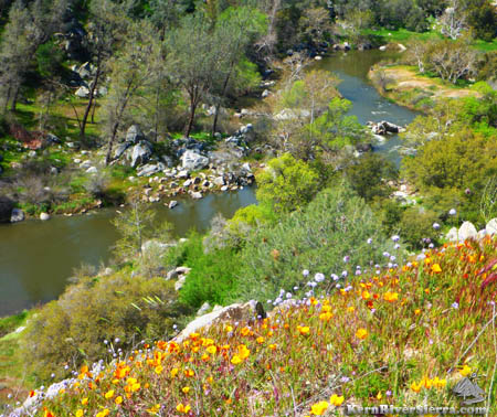
China Gardens at a huge horseshoe bend in the Kern River. |
THE STATS
- Miles: 1-4.5 miles.
- Effort: 2,000-2,300 ft elevation range.
- Type: Out 'n' back hike with options.
- Tread: Non-Motorized Trail
- Sights: Wildflowers, fishing access, swimming holes (on low water years only)
- Where: SW of Lake Isabella
- Map: Kern River Sierra Outdoor Rec Map
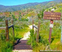 |
| Patch Corner Trailhead. |
|
The Trail
Providing access to a park-like setting with good river and fishing access, the Patch Corner Trail (31E82) makes a pleasant hike. This hike actually links two separate trailheads, The Patch Corner Trail and China Garden dirt road access (closed to vehicles). Officially, the Patch Corner Trail is 2 miles long.
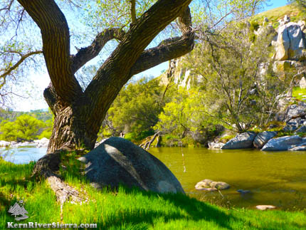 |
| A refreshing pool with rope swing. |
Hikers can start at either end, and sometimes link some of the nearby use-trails and old roads.
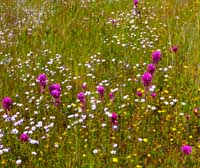
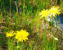
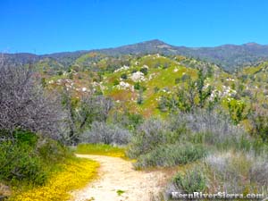
Depending on the year, this area can have some amazing wildflower displays. The drier hills slope down to the much greener riparian zone along the river. Watch out for poison oak in places, and always be wary of rattlesnakes!
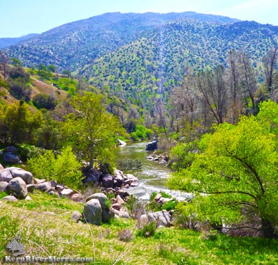
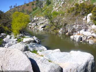
At low water levels, the Kern River provides some excellent swimming holes, rope wings, and some small cliff jumps in places. Even at low water, this section of the river is interspersed with some bigger rapids that should be avoided. At high flows, one can watch the rafts and kayaks navigated class 3 and 4 rapids.
The Hike
From the Patch Corner Trailhead off Hwy 178, hike over the cattleguard and continue on the main trail. (Almost immediately, there are some fainter trail offshoots that head toward the river.)
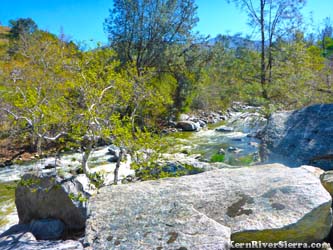
A more defined split is encountered in less than 1/4 mile from the trailhead. The short steep trail down to the right is a worthy diversion to the Kern River. It leads to a boulder grotto at the end of a rapid and a nice swimming pool.
 |
|
| A wonderful hike in the Spring. |
Continuing on the main trail, the singletrack contours the grassy hills before reaching the river in 0.5 miles.
After coming to a calm pool (low water), the trail continues through some rocks along the river. This section may be under water at very high flows.
 |
A walk in the park. |
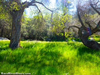
Then the trail continues along the river to an idyllic spot with a small creek, lush green grasses, and a huge Cottonwood. A rope swing is inviting on a hot day. Across the river, the bank is built of gorgeous granite speckled with wildflowers.
The pool ends at a rapid below. The trail continues on, although it can be a bit fainter. A use-trail continues on the river and over some boulders, while the original trail veers left. It is easy to miss.
Roughly a mile into the hike, there are some trail splits and evidence of old roads. Hikers might have to do a little exploring here.
After passing one of the bigger rapids, the trail starts to climb up the hillside to the plateau above China Gardens. There is a split, but both ways lead to the gated and closed China Garden road. (Ignore the road on the left that leads to a house and a mining claim.) Hiking back down the main road (about 1/2 mile) to China Garden is pleasant and often has wildflowers in the Spring.
 |
Hiking around China Garden. |
The only people you'll see are those that hike or bike in either from China Garden, Patch Corner, or possibly from the Kern River Trail on the other side of the river.
The rest of the hike is an out 'n' back, unless some of the faint use-trails and side-roads are explored.
Other Nearby Trails
Trailhead & Directions
The trailhead is off Hwy 178 southwest of Lake Isabella before Kern Canyon Road and the USFS Democrat Station.
 |
|
| Taking the first trail split right, leads to a rapid and a pool. |
 |
| Near the top of the trail. |
From Lake Isabella, drive southwest on Hwy 178 about 12.5 miles. Cross the Delonegha Bridge and after about 1.3 miles, look for a very small sign that says Democrat heliport on the right. Skip the heliport, but not very far after this there is a blind (but large) dirt pull-out on the right. This is just before the freeway curves left and meets Kern Canyon Road.
The trailhead is signed at the end of the pullout.
This is about 25 minutes southwest of Kernville.
From Bakersfield, take Hwy 178 up through the Kern Canyon approximately 24 miles. The 2 lane road turns to 3 lanes near the Democrat Fire Station (at Kern Canyon Rd). After passing Kern Canyon Rd and a cattle guard, the trailhead will be on the left on the bend.
|
