A pleasant hike with numerous visual delights, especially in the Spring.

Springtime on the Mill Creek Trail. |
THE STATS
- Miles: 5.6+ miles roundtrip
- Effort: 1000 feet of elevation gain
- Type: Up & back motorized multi-use trail
- Land: Sequoia National Forest
- Where: Kern Canyon Rd, SW of Lake Isabella
- Map: Kern River Sierra Outdoor Rec Map
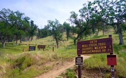 |
| Trailhead on Kern Canyon Rd. |
|
April 2025 Update!
The trail is absolutely popping with vibrant green and wildflowers, and the creek crossings are a little challenging!
The lower half of the trail is unaffected by the 2024 Borel fire, while the middle section includes patchy burn areas and will probably get a little bushy as the spring growth kicks in. Some of the ridge areas are rutted. The greenery, miner’s lettuce, and flowers are quite striking with the blackened trees. As you climb higher on the trail the burn damage increases. There are about 4 small trees down, and one large Ponderosa. |
The Trail
Mill Creek Trail is hiked year round but it makes for an especially delightful trek in the Spring.
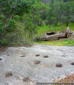 |
Acorn powerbars were made here. |
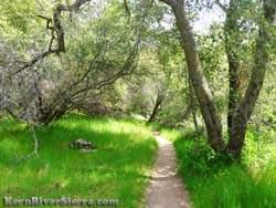
Along the trail, you'll initially encounter rolling hills studded with oaks and granite boulders and then suddenly everything is lushly green as the trail weaves through the riparian zone.
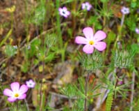
Splashes of color abound in the spring, when the area's diverse abundance of wildflowers emerge. At the tune of trickling water, the trail crosses Mill Creek a few times before climbing a few switchbacks to a grassy flat near the destination of this hike.
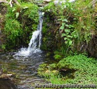
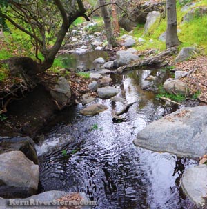
Evidence of past civilization is seen in the mortar holes hovering above an idyllic setting of small cascading waterfalls, lilly pads, and cute salamander-filled pools.
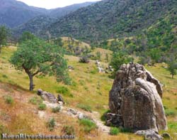
An optional hike up the nearby knoll offers panoramic views of Breckenridge Mountain, Lightner Peak, a large dry (not always) waterfall on the hillside, and fields of wildflowers.
|
|
| Sunny & exposed. |
Lush & shady. |
The Hike
 |
It's hard to imagine this scene during the peak summer months. |
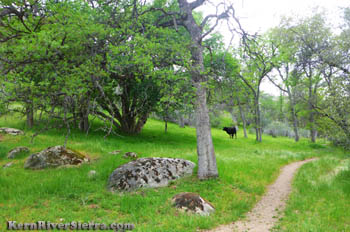
Mill Creek is a motorized multi-use trail, with all types of users including free-range cattle.
Thankfully, the hike is well maintained by Backcountry Horsemen of California and Stewards of the Sequoia.
From the trailhead sign near the road, start hiking up the trail, which will traverse over into the Mill Creek Valley. The trail borders a ranch, so ignore any cow trails veering off.
After cruising through the open hills the trail will cross the creek for the first time and make some short climbs and descents.
In less than 2 miles the hike reaches a flat section on the ridge. Mill Creek is now off to the right (to the west), while the hike now ascends a tributary to Mill Creek.
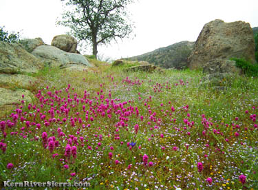 |
A knoll just above the Mortar Holes displays flowers and provides a panorama view of the surrounding mountains. |
After climbing a few switchbacks, the trail reaches a large flat with the remnants of an old barbed wire fence. In the spring, the sight of the rich green grass on the slopes and jingling of large cow bells might seem more like an Alps scene from 'Sound of Music' rather than the Breckenridge Mountains.
The Native American granite mortar holes lie just out of sight, closer to the creek below the trail.
Up above, a view of the usually-dry creek and waterfall fall off Lightner Peak.
Follow the now-defunct Farmer Driggs Trail (which climbed all the way to Lightners Flat) down to the branch of Mill Creek. A wonderful shady spot among huge alders, cascading pools, lilly pads and moss-covered boulders awaits.
 |
| The side canyon to Mill Creek. |
One can continue hiking up the Mill Creek Trail, or trek off trail up the knoll for the views described above.
Other Nearby Trails
Trailhead & Directions
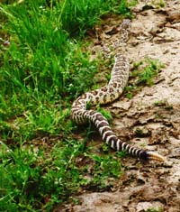 |
2 things to avoid: cow $h@t and rattlesnakes! |
Mill Creek trail is located on the southwestern end of Kern Canyon Road off the 178.
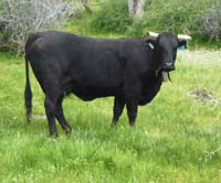 |
Happy Cow. |
From Lake Isabella, drive southwest on the 178 about 13 miles and turn left on Kern Canyon Rd.
Drive about 1.5 miles to the trailhead sign on the right.
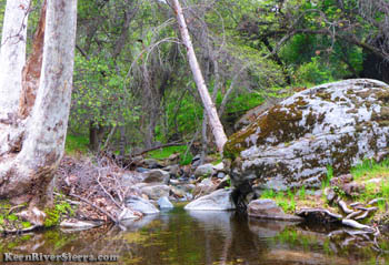
A small pool at one of the 4 creek crossings.
|
 |
|
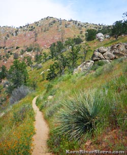
On the trail. |
|